
August 18, 2024 Flash Flood
Devastating Flash Flooding in Fairfield & New Haven Counties

The August 18, 2024 flash flood in southwestern Connecticut was an exceptional and localized event. The flood was not well forecast with rainfall amounts far exceeding what was anticipated. The event challenged the 24-hour rainfall record for Connecticut and destroyed dozens of homes, businesses, bridges, and roads. Sadly, 3 people lost their lives in the flood.
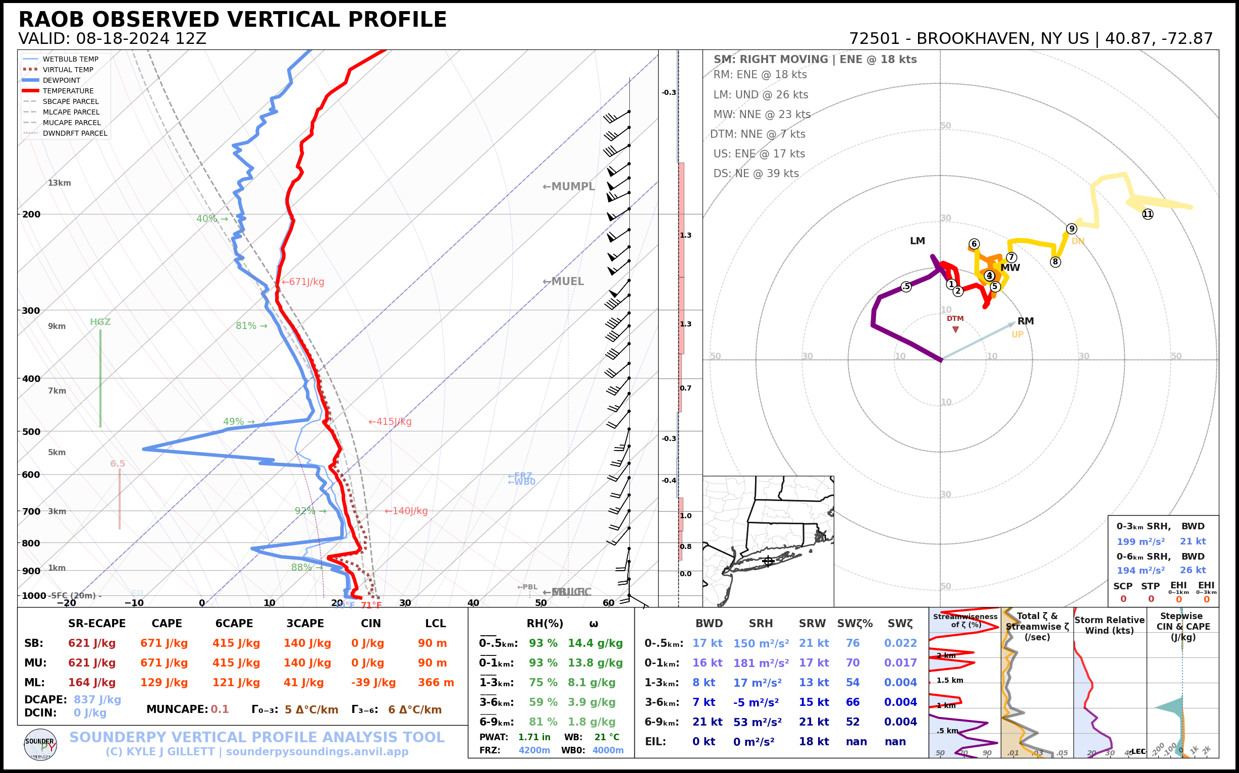
The atmosphere was quite moist on August 18, 2024 but not exceedingly so. The morning weather balloon launch on Long Island had precipitable water of 1.71” which is close to the 90th percentile (1.77” per SPC Sounding Climatology) for August 18.
The 12z sounding shows “tall and skinny” CAPE which is common in flash flood events with high freezing levels and low level warm advection (veering winds from the surface to 850mb).
The combination of instability, deep warm-cloud depth1, and synoptic scale lift would check many of the boxes for a flood threat. That said, nothing here is fairly remarkable! This is a pretty typical looking environment for summer in New England.
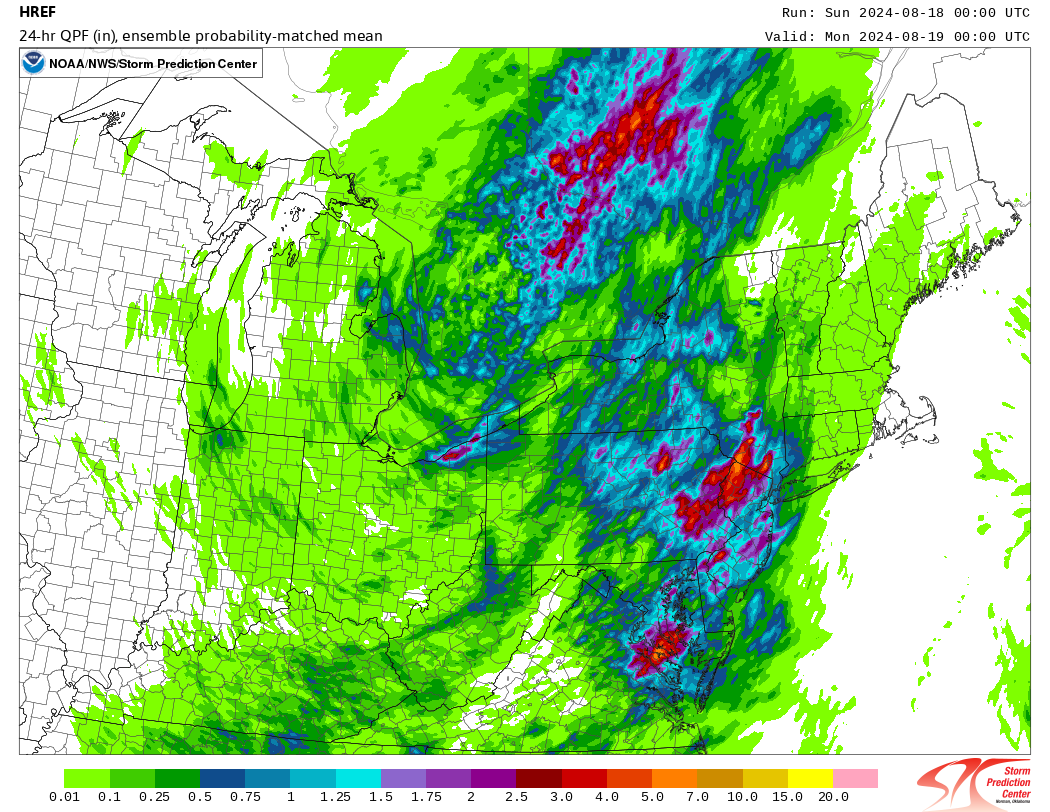
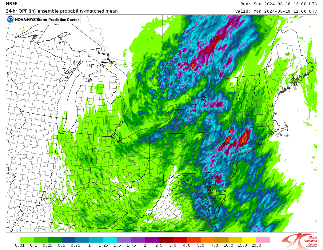
The overnight computer guidance (00z on August 18th) didn’t show much of a flood threat locally. The HREF (High Resolution Ensemble Forecast) which is made up of several high resolution convection allowing models showed the potential for heavy rain west of Connecticut. The 12z run, however, shows a much more concerning rain signal locally. A 50 mile shift in this case resulted in a dramatically different result in Connecticut.
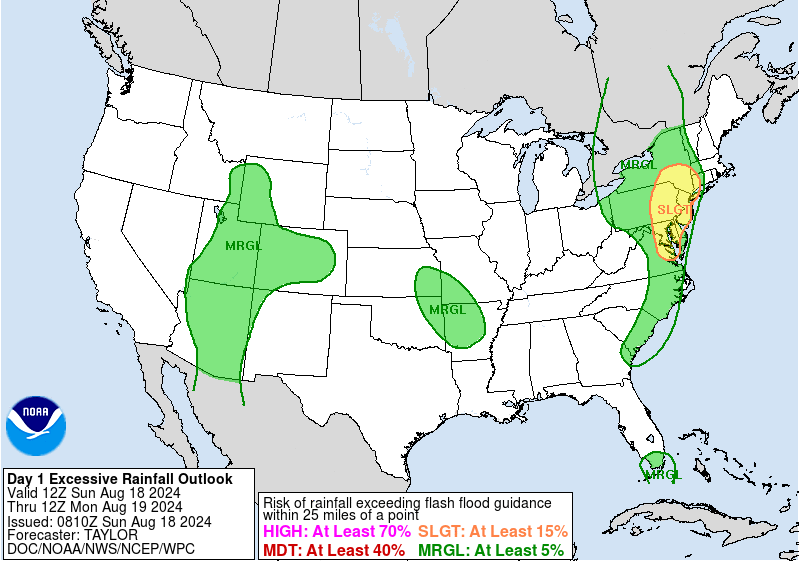
The Excessive Rainfall Outlook from the Weather Prediction Center the morning of August 18 showed a slight risk for flash flooding in far western Connecticut.
So what happened? The surface analysis at 18z from the WPC may offer a clue. While there isn’t a front analyzed in southern Connecticut one could certainly see a weak front just inland from Long Island Sound with southerly flow over Long Island and coastal Connecticut (along with dew points in the low 70s) and weaker northeasterly flow farther inland over northern Connecticut.
This front along with frictional convergence and a bit of upslope with southeasterly flow from Long Island Sound up to the hills around the Naugatuck and Housatonic Valleys.
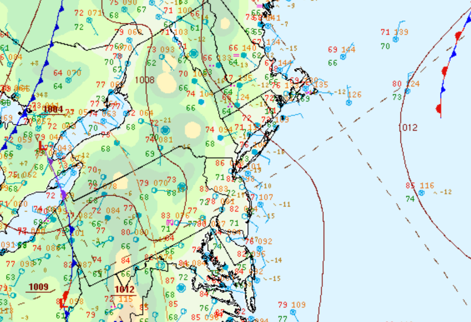
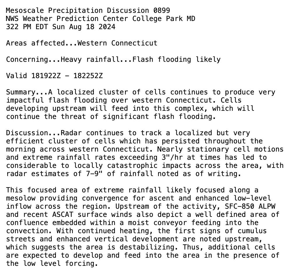
The WPC Mesoscale Precipitation Discussion also mentions the presence of a subtle mesolow which effectively focused the convection and heavy rain in the same area hour after hour.
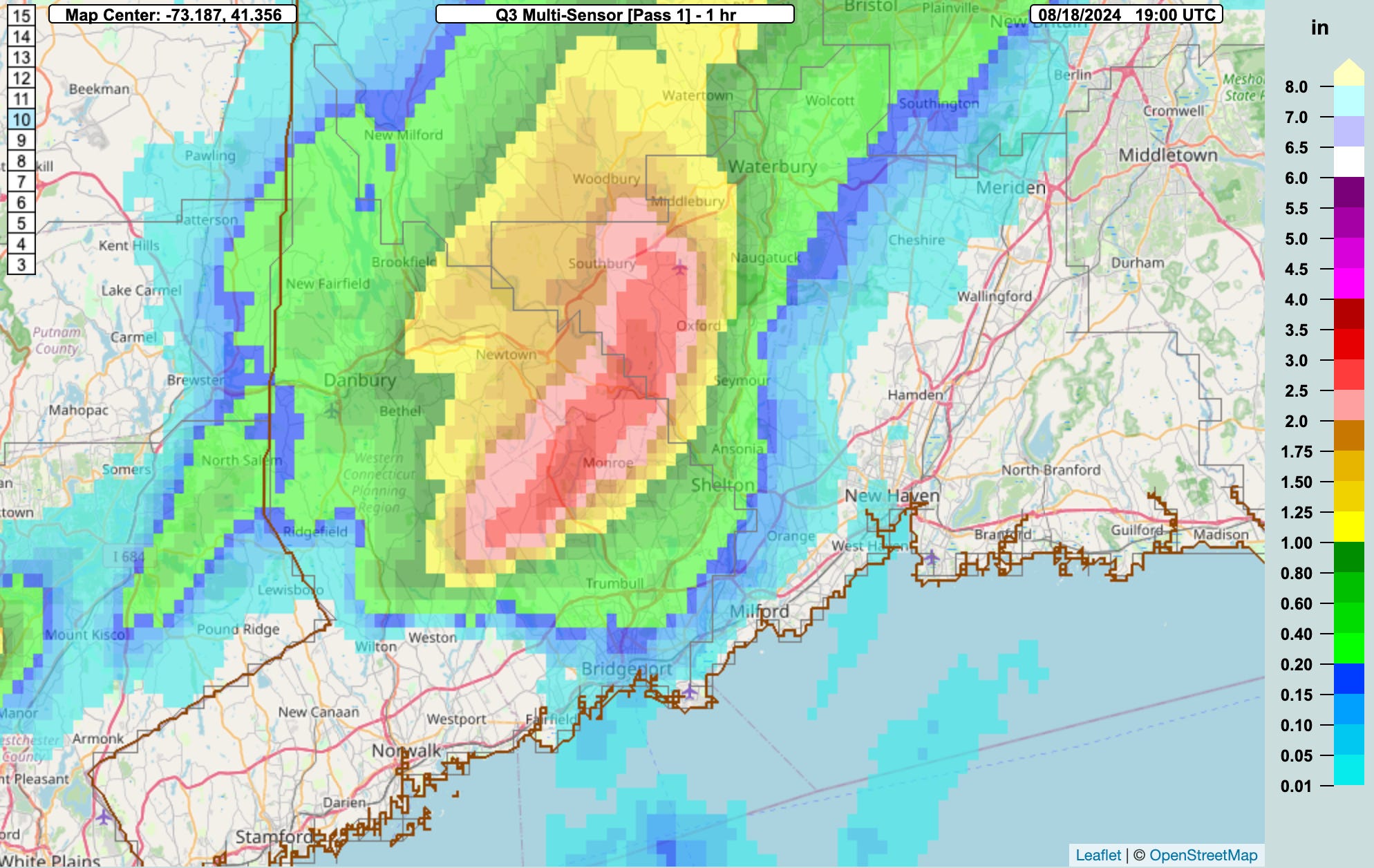
The rainfall rates and totals were astounding. The Multi Radar Multi Sensor (MRMS) gives us a great look at how rare and impactful this event was.
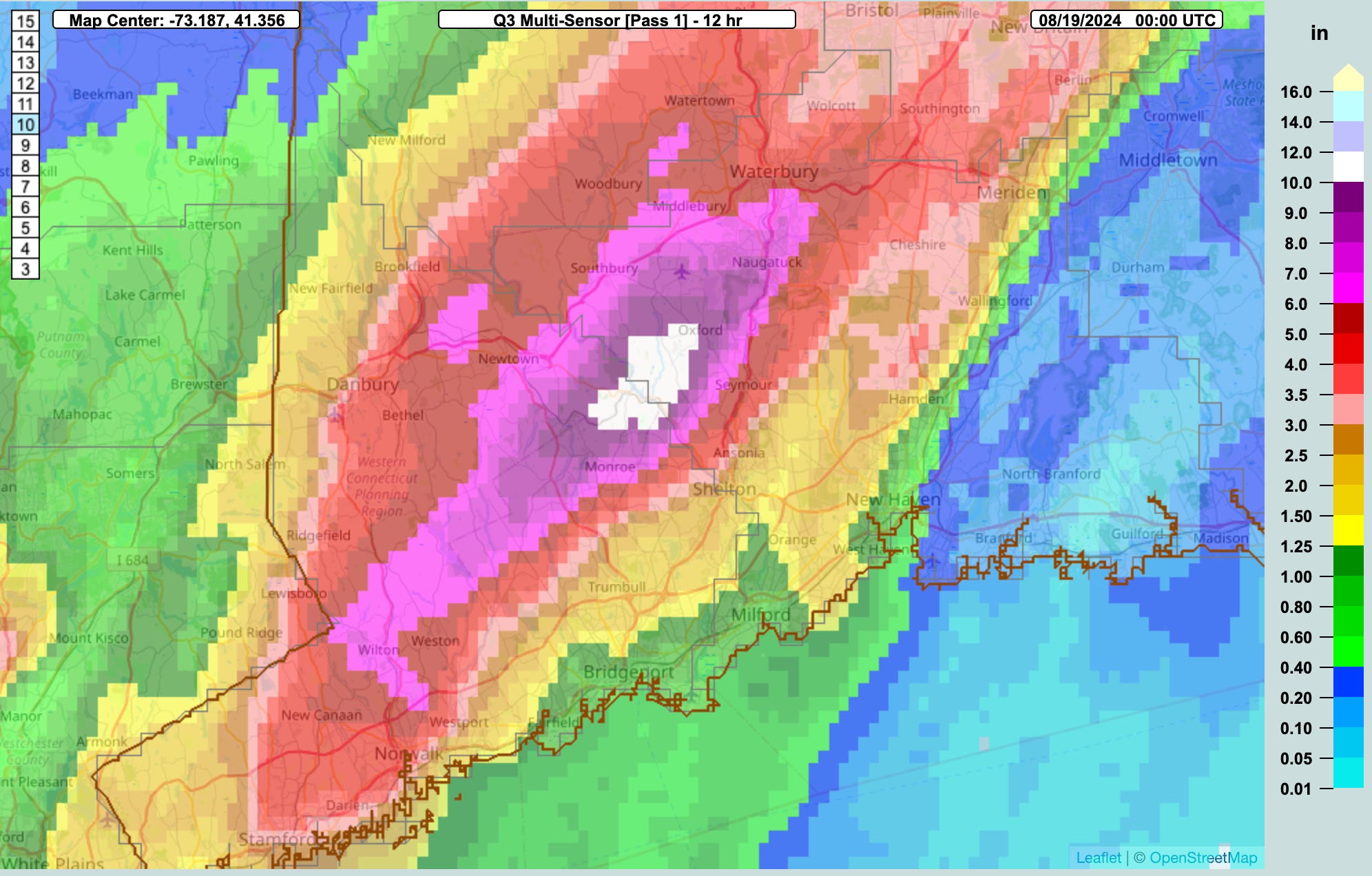
12-hour totals exceeded 10” across Oxford and Monroe. The peak 1-hour rainfall total estimated by radar was between 3” and 4”.
This kind of rain had a recurrence interval of 50 to 100 years. That means for parts of Oxford, Monroe, and Southbury this amount of rain in such a short duration has only a 1 to 2% chance of occurring any given year.
Here are some of the higher rainfall totals from observers in the area2.
Oxford - 14.83”
Oxford - 13.52”
Oxford - 13.50”
Sandy Hook - 12.17”
Newtown - 10.00”
Shelton - 9.99”
Middlebury - 9.55”
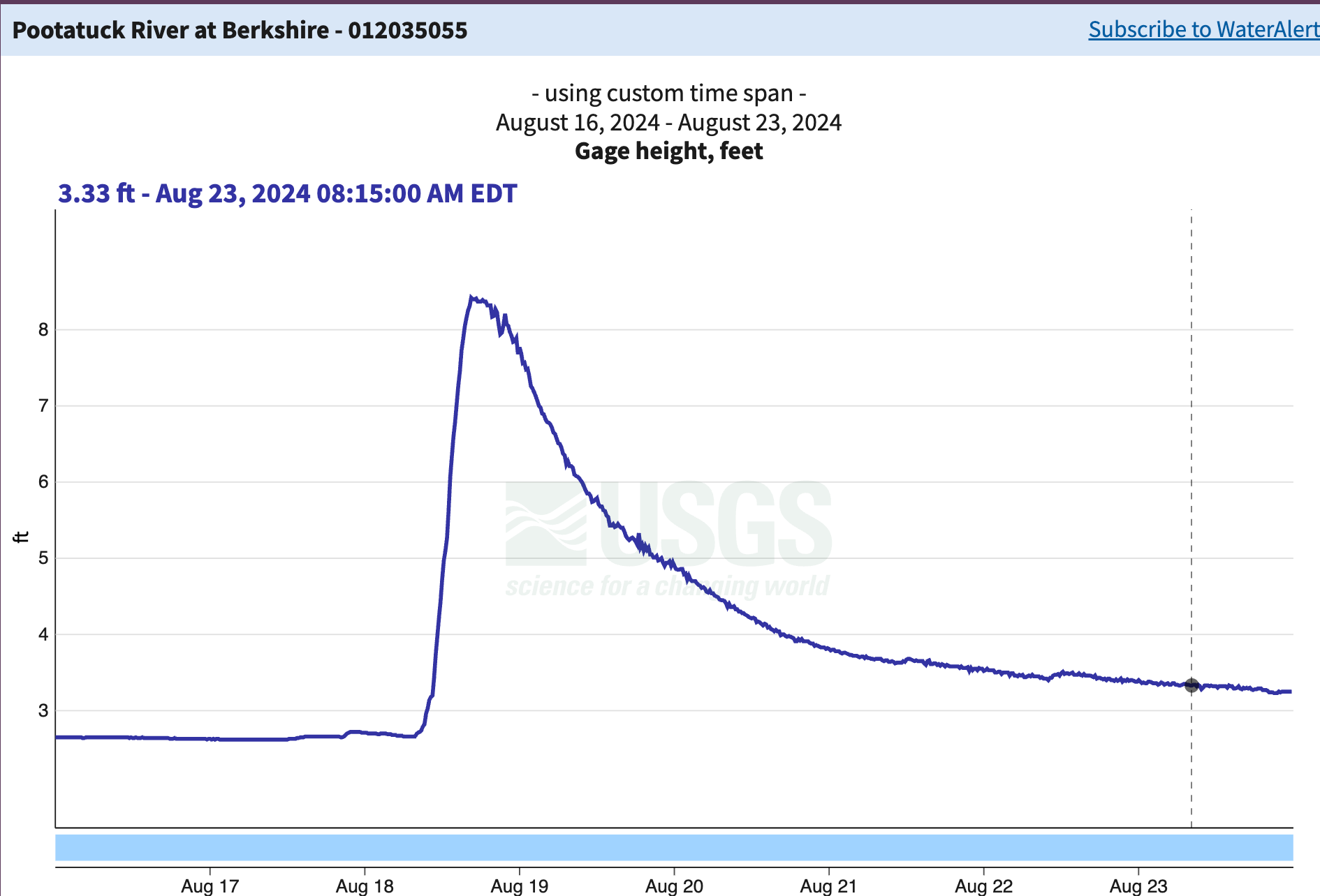
Many rivers rose dramatically after all this rain and runoff. Check out this hydrograph from the Pootatuck River in Newtown which crested over 8 feet. This is the highest since the gauge was installed in 2007.
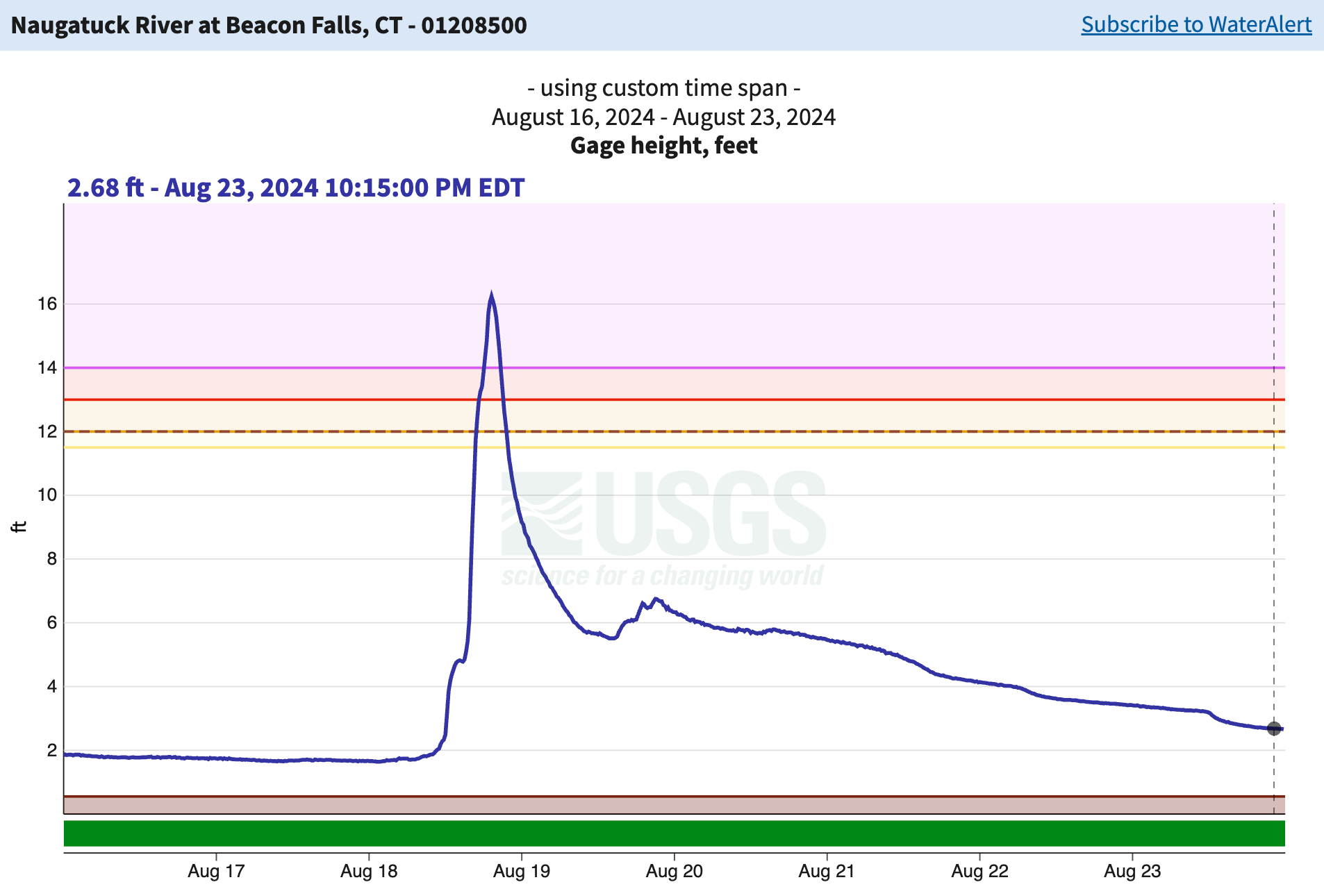
The Naugatuck River in Beacon Falls crested over 16 feet following the rain. This resulted in major flooding along the river and was the highest crest since the flood of 1955. After Irene the river crested around 14.3 feet in 2011.
While the initial forecasts were not good. The warnings issued that day were good and timely for Fairfield and New Haven Counties.
Flash Flood Warning issued at 9:26 a.m.
Flash Flood Warning threat upgraded to “considerable” at 12:00 p.m.
Flash Flood Emergency issued at 2:52 p.m.
Here’s the result of that much rain in such a short period of time.


19 destroyed homes
170 homes with major damage
Hundreds more with minor damage
77 businesses with major damage
41 businesses with minor amage
1700 households impacts
30 state roads closed
5 rail lines closed
State DOT damage exceeded $50 million
The August 18th flash floods offer some lessons for meteorologists.
First, despite significant advances in forecasting, we still struggle to accurately predict the location and development of small-scale events like this. More convection-allowing models and ensemble approaches are needed to address this ongoing predictability challenge.
Second, accurate and timely warnings alone aren't always enough. Three people died in the flood, even with the highest level of flood warning in effect. Whether due to warning fatigue, communication breakdowns, or individuals underestimating their personal risk, this remains a critical gap we have yet to solve.
High freezing levels result in a deep “warm cloud” depth. This is important to maximize collision-coalescence through the cloud resulting in more efficient precipitation production.
These rainfall totals were examined by the State Climate Extremes Committee as some would break the existing 24-hour rain total from the 1955 flood. The SCEC found that due to sighting issues and lack of additional information these unofficial totals were not able to be certified as record breaking.