

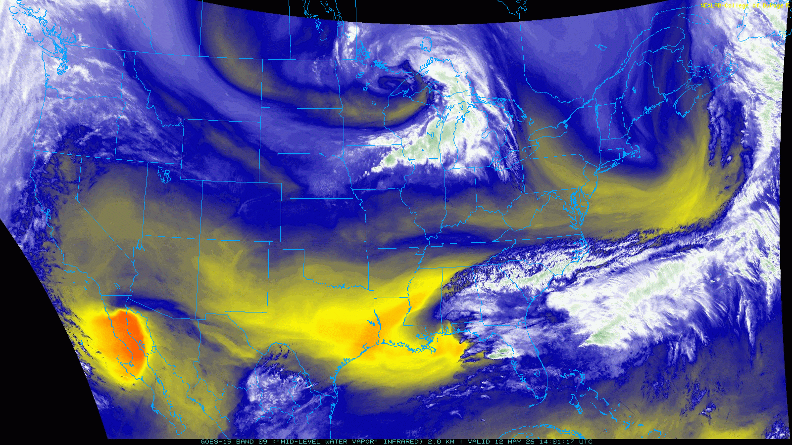
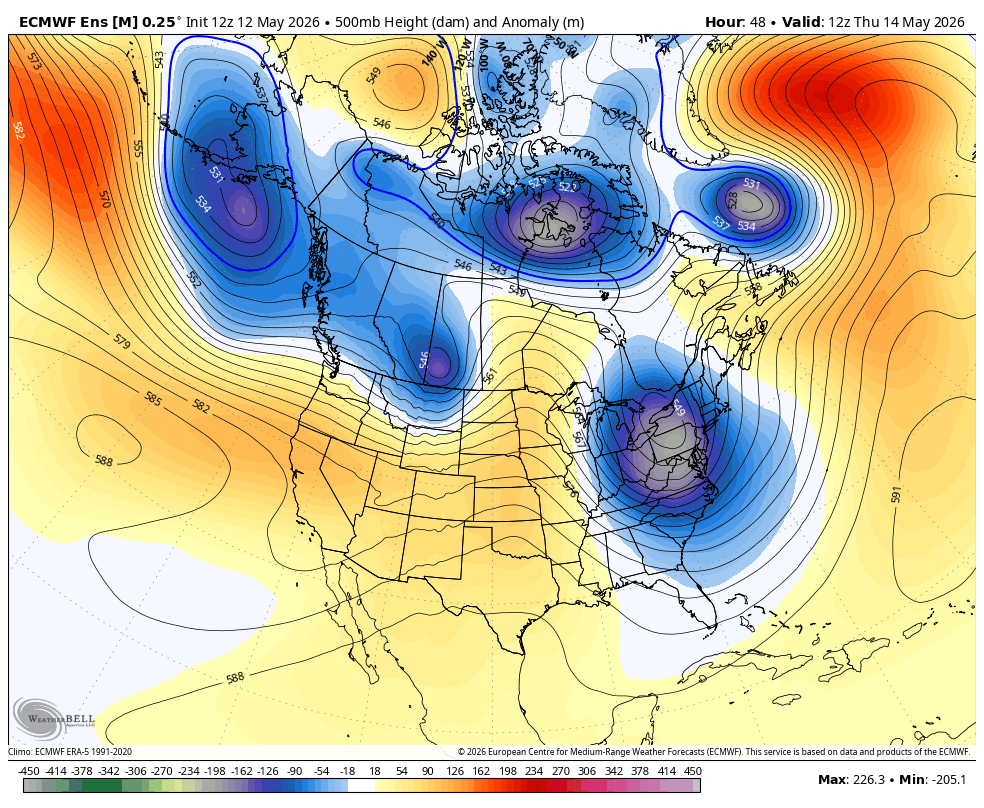
A strong upper-level low is racing south and east toward New England. By the time it arrives, however, it will slow to a crawl.
Clouds will overspread Connecticut Wednesday morning, with a few showers developing as the system approaches. Temperatures will climb into the mid 60s, with some breaks of sun possible. One concern will be a strong, gusty breeze.
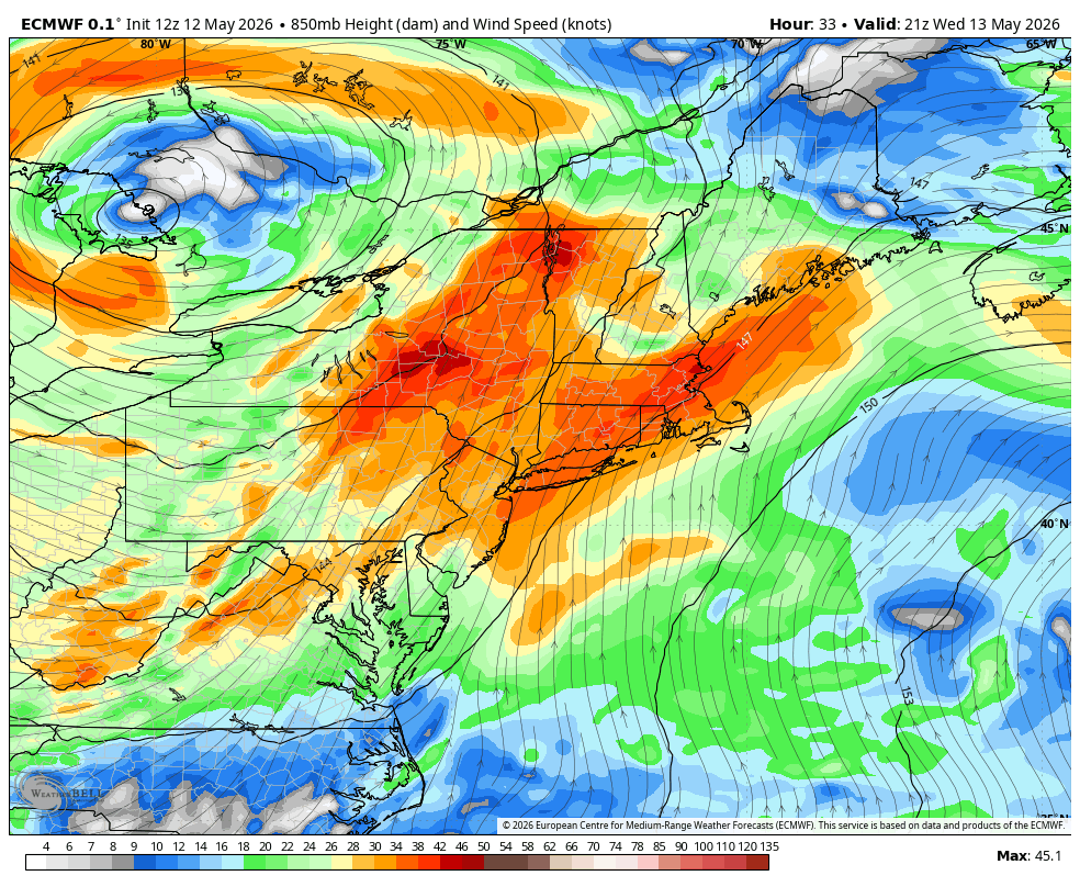
Winds at 850 mb will approach 40 knots Wednesday afternoon, and it looks like we’ll be able to mix down a decent portion of that as temperatures warm. Right now, I’m expecting wind gusts up to 35 mph, but if we get a bit more sun than expected, gusts could be stronger.
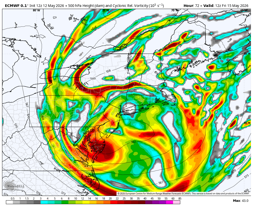
As the upper-level low cuts off and passes to our south and west, we will see periods of rain develop Thursday, with some downpours possible. There’s still some question as to the exact evolution of the system. The European model, for instance, is a bit farther south, which would place the axis of heaviest rain over southern New England. Other models are farther north, which would shift that axis north as well.
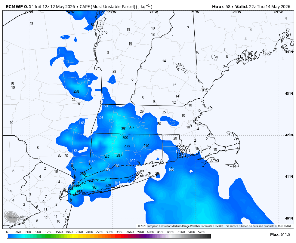
Models show some modest instability developing Thursday, which would favor localized pockets of heavy rain and even some thunder.
You can see the uncertainty when looking at forecast rainfall totals. The European ensemble shows a mean of about 1.25" of rain in the Hartford area, with individual runs ranging from 0.25" to 2.5"—a wide spread.
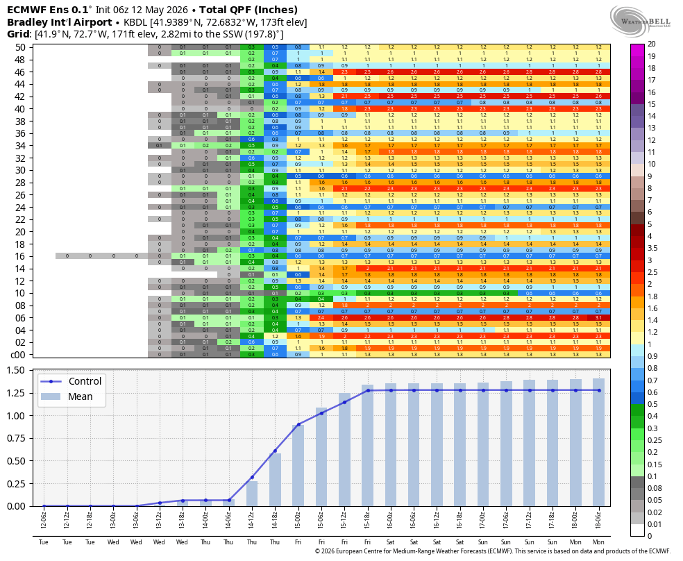
The GFS ensembles also show considerable spread, with 10th and 90th percentile forecasts of 0.4" and 1.3", respectively.
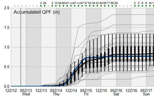
The bottom line is a widespread 0.5”–1.0” of rain across the state, with pockets of 1”–2” possible. These upper-level lows can be tricky, so we’ll need to watch trends and wobbles over the next 24 hours.
Leftover clouds are expected on Friday, with temperatures in the low 60s as the storm lingers near New England. Much better weather arrives for the weekend as a large ridge of high pressure builds in. Expect sunshine and temperatures in the upper 70s Saturday and low 80s Sunday, though it will be a bit cooler along the Sound.
While the 80s won’t stick around all next week, temperatures generally look near to above normal in the 6–10 day forecast.
Here is your Daily Weather Almanac for Wednesday, May 13, 2026
🏙️ Hartford Area 30 Year Normals
- Normal High: 71°F
- Normal Low: 48°F
🏛️ Hartford Area (BDL) Records
- Record High (max temp): 87°F (1947)
- Record Low (min temp): 32°F (2010) (tie — also in 2005, 1962)
- Record Highest Minimum: 63°F (2022) (tie — also in 1979)
- Record Lowest Maximum: 45°F (1914)
- Record Precipitation: 1.77 in (1921)
- Record Snowfall: 0.0 in (2025)
- Max Snow Depth: 0 in (2025) ⚠️ (monthly record)
🏖️ Bridgeport Area (BDR) Records
- Record High (max temp): 88°F (1956)
- Record Low (min temp): 37°F (2020)
- Record Highest Minimum: 61°F (2023)
- Record Lowest Maximum: 51°F (2002)
- Record Precipitation: 1.43 in (2002)
- Record Snowfall: 0.0 in (2025) ⚠️ (monthly record)
- Max Snow Depth: 0 in (2025) ⚠️ (monthly record)
🌅 Sunrise & Sunset
- Sunrise: 05:33
- Sunset: 20:02
🌙 Moon Phase
----------------------------------------
- Next Moon Phase: New Moon on Sat May 16, 2026
📅 Calendar
----------------------------------------
- Next 3 Holidays:
- Memorial Day on Mon May 25 (in 12 days)
- Juneteenth National Independence Day on Fri Jun 19 (in 37 days)
- Father's Day on Sun Jun 21 (in 39 days)
🌊 New Haven High Tides
- 08:51 AM EDT • 6.02 ft
- 09:10 PM EDT • 6.95 ft
🌊 Old Saybrook High Tides
- 08:17 AM EDT • 3.45 ft
- 08:39 PM EDT • 4.41 ft
🌊 New London High Tides
- 07:06 AM EDT • 2.53 ft
- 07:28 PM EDT • 3.24 ft