

It’s been a beautiful start to Wednesday, but the end won’t be quite as nice. Clouds will thicken this evening, with rain developing later tonight.
Rainfall totals won’t be terribly impressive. In fact, trends over the past day of model runs have come in slightly lower. The National Blend of Models has reduced the mean rainfall to generally 0.25–0.40” across the state. Heavier totals are expected both west and east of us.
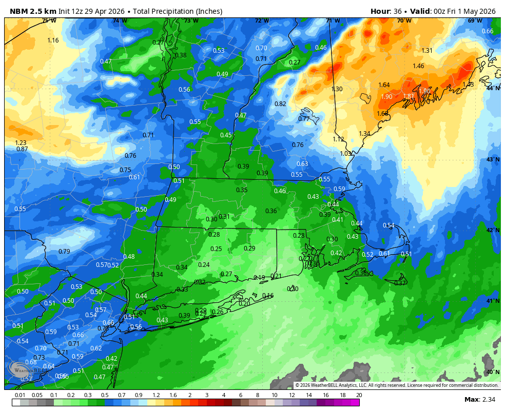
It seems that the two relative maxima on either side of us are due to two separate processes. A tongue of instability in the Mid-Atlantic may enhance rainfall potential across New Jersey and Pennsylvania (perhaps a scattered thunderstorm or two), while a low-level convergence zone over Maine will enhance rainfall there.
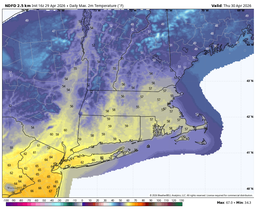
Regardless, it will be wet later tonight and Thursday morning. Most of the rain should move out by mid-morning, with a few breaks of sunshine developing by the afternoon. Winds will gust out of the northwest up to 30 mph later in the day as we dry out, with temperatures around 60°.
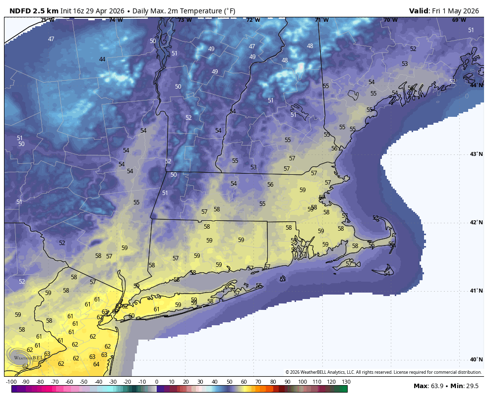
Temperatures will remain cool on Friday, with highs in the upper 50s to near 60° for most areas.
While we’re in between systems Friday night and Saturday morning, patchy frost is possible in rural parts of the state. Light winds, clear skies (with a full moon), and dry air with dew points in the 20s should allow temperatures to drop to near 30° in some spots.
As mentioned yesterday, there will be an area of low pressure tracking offshore this weekend. This remains something to watch. The GFS ensemble shows the storm well south of the 40°N/70°W benchmark, but close enough for some light precipitation later Saturday into Saturday night.

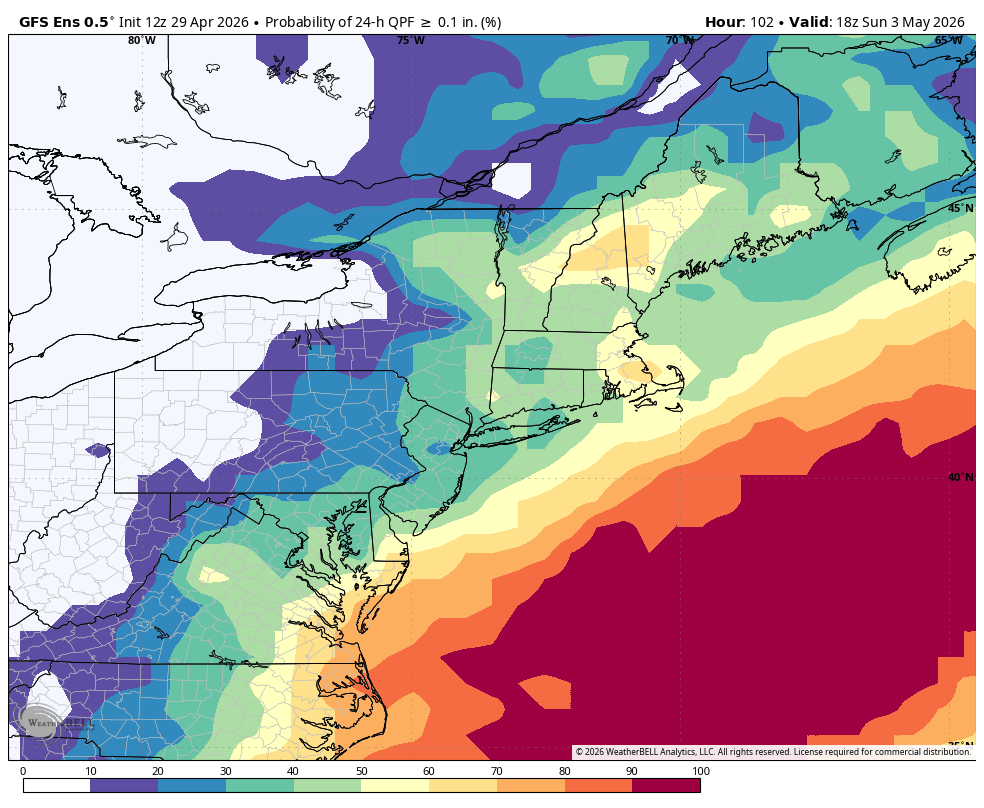
The probability of >0.1” of precipitation on the GEFS has increased to around 40%, focused on Saturday night. We’ll continue to watch trends, but a reasonable worst-case scenario right now would be a period of light rain later Saturday, ending by daybreak Sunday.
Next week continues to look unsettled, with several chances for rain and a deep, stubborn dip in the jet stream overhead
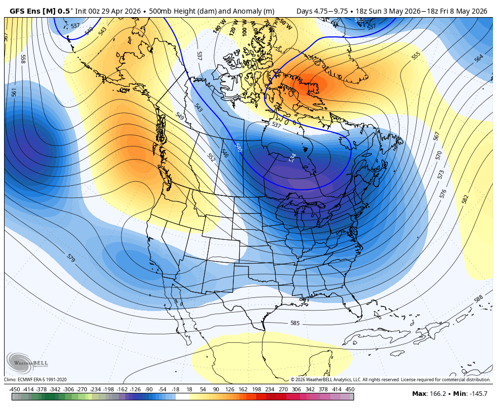
Temperatures for the week overall should average below normal but I do think a day or two of warmer-than-normal weather (i.e. 70s) are possible in between systems.
Here is your Daily Weather Almanac for Thursday, April 30, 2026:
🏙️ Hartford Area 30 Year Normals
- Normal High: 67°F
- Normal Low: 44°F
🏛️ Hartford Area (BDL) Records
- Record High (max temp): 86°F (1942)
- Record Low (min temp): 31°F (1978)
- Record Highest Minimum: 56°F (1983) (tie — also in 1936)
- Record Lowest Maximum: 39°F (1909)
- Record Precipitation: 1.94 in (2014)
- Record Snowfall: 0.2 in (1909)
- Max Snow Depth: 10 in (1924)
🏖️ Bridgeport Area (BDR) Records
- Record High (max temp): 79°F (2007)
- Record Low (min temp): 38°F (2008) (tie — also in 1992)
- Record Highest Minimum: 55°F (2025) (tie — also in 1974, 1957)
- Record Lowest Maximum: 46°F (1950)
- Record Precipitation: 2.50 in (2014)
- Record Snowfall: 0.0 in (2025)
- Max Snow Depth: 0 in (2025)
🌅 Sunrise & Sunset
- Sunrise: 05:48
- Sunset: 19:48
🌙 Moon Phase
----------------------------------------
- Next Moon Phase: Full Moon on Fri May 01, 2026
📅 Calendar
----------------------------------------
- Next 3 Holidays:
- Mother's Day on Sun May 10 (in 10 days)
- Memorial Day on Mon May 25 (in 25 days)
- Juneteenth National Independence Day on Fri Jun 19 (in 50 days)
🌊 New Haven High Tides
- 11:14 AM EDT • 6.17 ft
- 11:24 PM EDT • 6.91 ft
🌊 Old Saybrook High Tides
- 10:30 AM EDT • 3.25 ft
- 10:41 PM EDT • 4.32 ft
🌊 New London High Tides
- 09:19 AM EDT • 2.39 ft
- 09:30 PM EDT • 3.18 ft