

Good afternoon!
It’s been a beautiful Thursday—sunny, windy, and warm across Connecticut. Temperatures climbed to near 70° in most valley and shoreline locations.
Tonight’s weather will be relatively quiet, though clouds will increase, and there’s a slight chance for a sprinkle toward daybreak as a weak upper-level shortwave moves through.
Friday will be partly to mostly sunny and not quite as warm as today. Highs will generally be between 60 and 65 degrees.
Saturday’s forecast remains a tricky one. Below are the 24-hour precipitation totals for Saturday and Saturday night around the area. The models are actually in remarkably good agreement. That said, given the very sharp gradient, a 20–30 mile shift will make a huge difference here.
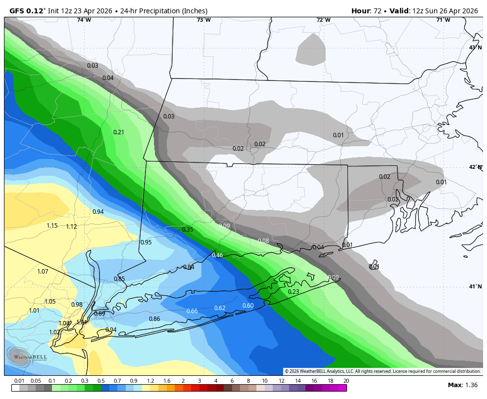
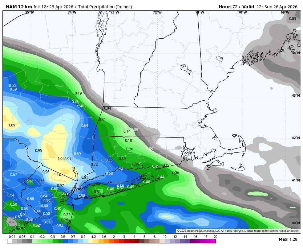
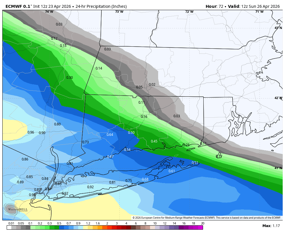
I expect a rainy afternoon and evening in Fairfield County and not much rain (if any at all) in Windham County. The I-91 corridor is a much harder call, even at this juncture.
One new wrinkle that has shown up today (and was hinted at yesterday) is the potential for this system to hang around into Sunday. The European Ensemble is the most emphatic about this potential, and the Canadian model has hopped aboard. Basically, a few models show the disturbance diving south of New England and developing into a coastal low as a cut-off upper-level low develops. You can see the difference below between the more progressive GFS (which keeps the upper-level trough moving) and the Canadian (which eventually cuts off the upper-level low off New Jersey).
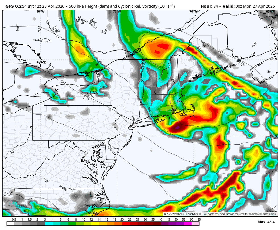
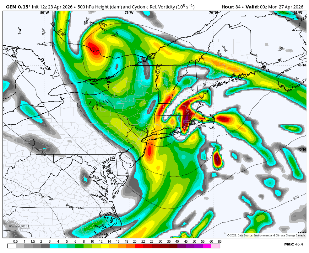
This would mean a continuation of clouds and rain into Sunday. At this point, this seems unlikely, but cut-off lows love to form this time of year, throwing all sorts of wrenches into otherwise solid forecasts!
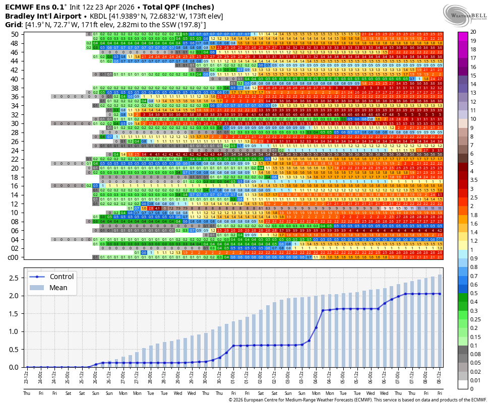
Next week continues to look unsettled, with multiple opportunities for rain. The European Ensemble has an average mean of about 2 inches of precipitation by next weekend, with some members showing significantly more rain.
Enjoy another decent looking day of weather ahead of weekend!
Here is your Daily Weather Almanac for Friday, April 24, 2026
🏙️ Hartford Area 30 Year Normals
- Normal High: 65°F
- Normal Low: 42°F
🏛️ Hartford Area (BDL) Records
- Record High (max temp): 88°F (2001)
- Record Low (min temp): 27°F (1930)
- Record Highest Minimum: 52°F (2011) (tie — also in 1982, 1935, 1913)
- Record Lowest Maximum: 42°F (1967)
- Record Precipitation: 2.25 in (1944)
- Record Snowfall: 1.1 in (1967)
- Max Snow Depth: 10 in (1924)
🏖️ Bridgeport Area (BDR) Records
- Record High (max temp): 78°F (2001)
- Record Low (min temp): 34°F (1989) (tie — also in 1967)
- Record Highest Minimum: 57°F (2008)
- Record Lowest Maximum: 43°F (1967)
- Record Precipitation: 1.88 in (1983)
- Record Snowfall: 0.0 in (2025)
- Max Snow Depth: 0 in (2025)
🌅 Sunrise & Sunset
- Sunrise: 05:57
- Sunset: 19:42
🌙 Moon Phase
----------------------------------------
- Next Moon Phase: First Quarter on Fri Apr 24, 2026
📅 Calendar
----------------------------------------
- Next 3 Holidays:
- Memorial Day on Mon May 25 (in 31 days)
- Juneteenth National Independence Day on Fri Jun 19 (in 56 days)
- Summer (June solstice) on Sun Jun 21 (in 58 days)
🌊 New Haven High Tides
- 05:44 AM EDT • 6.21 ft
- 06:23 PM EDT • 6.01 ft
🌊 Old Saybrook High Tides
- 05:11 AM EDT • 3.76 ft
- 05:44 PM EDT • 3.36 ft
🌊 New London High Tides
- 04:00 AM EDT • 2.77 ft
- 04:33 PM EDT • 2.47 ft