The Ice Storm of 1973 still stands as the benchmark ice storm in Connecticut. The storm plunged most of the state into frigid darkness for days and many remember it well 50 years later.
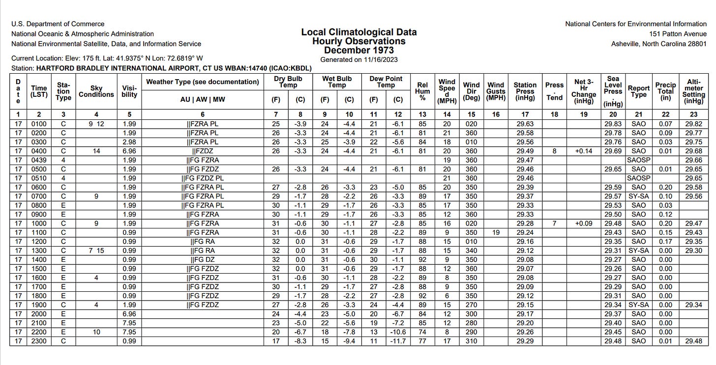
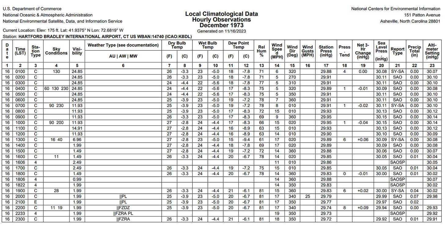
The storm began on the evening of December 16, 1973 and lasted into the morning of the 17th. In Windsor Locks sleet began falling around 8 p.m. and changed to freezing rain by 10 p.m. with a temperature of 25 degrees (hourly surface observations can be found at the bottom of this post).
A strong northerly wind kept the cold air in place through the overnight with the temperature not reaching freezing until noon the following day. 1.39” of precipitation fell at Bradley Airport - almost all of it was freezing rain.
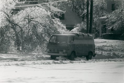
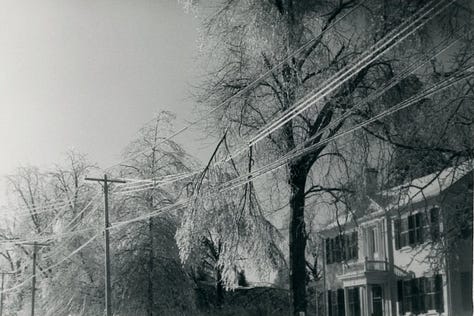
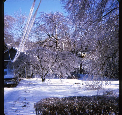

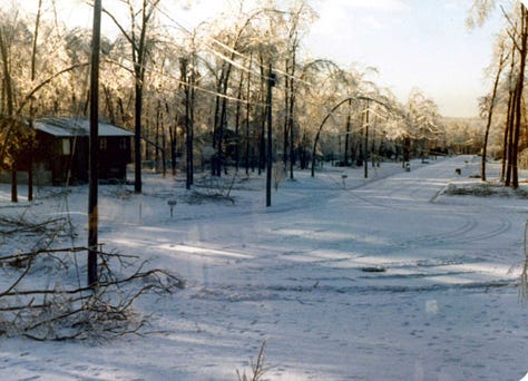
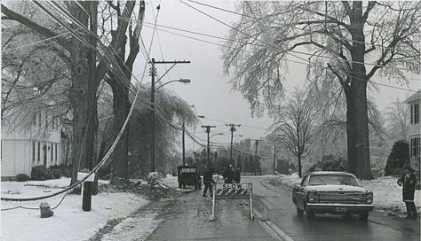
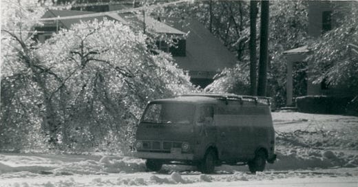
The result was extraordinary. Trees were caked in ice across the state from the shoreline to the hills of northeastern Connecticut. 278,000 Northeast Utility customers lost power - one of the largest power outages in state history at the time. That number was eclipsed by Hurricane Gloria 12 years later.
Here’s the Storm Data entry from the National Weather Service.
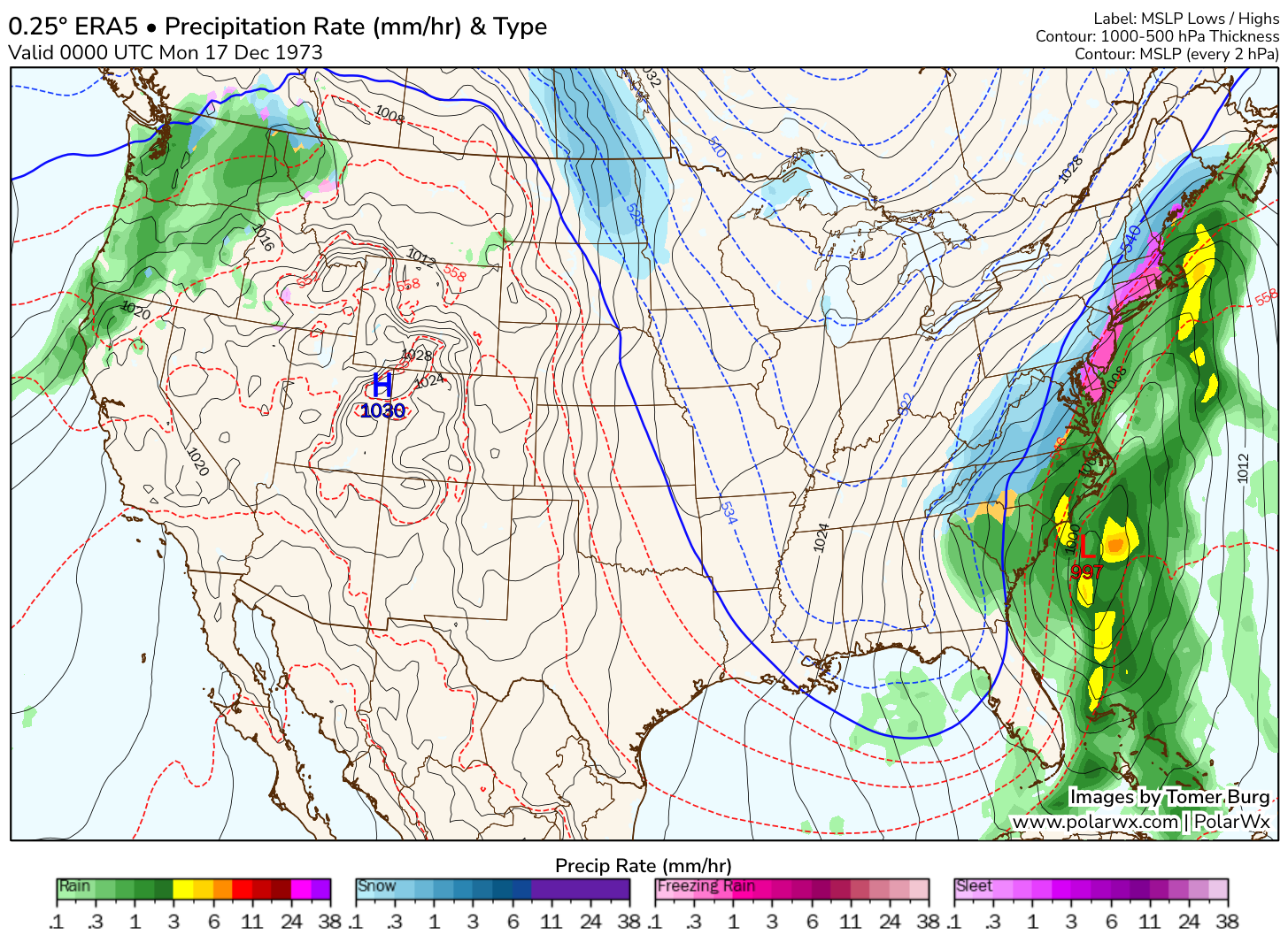
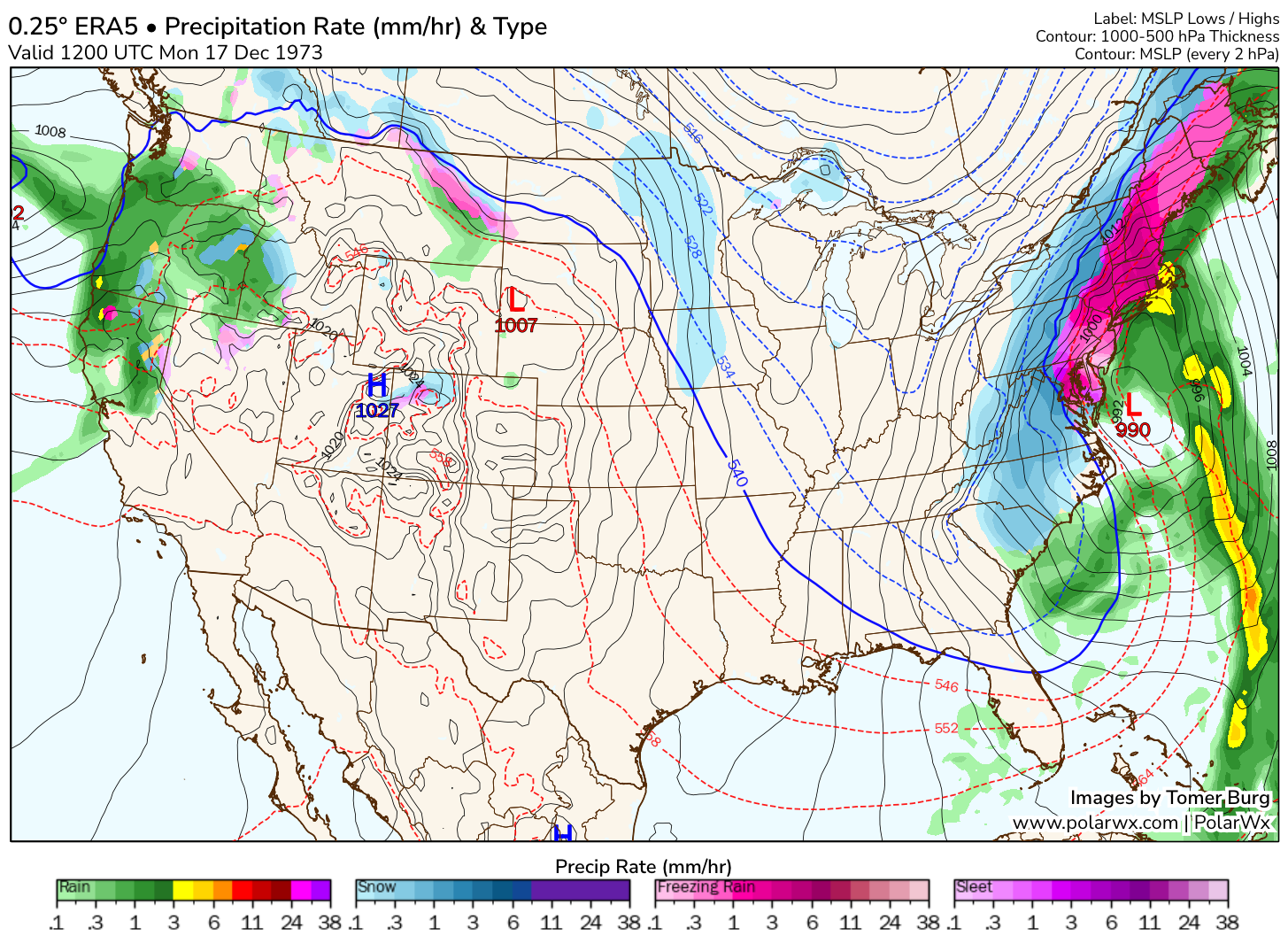
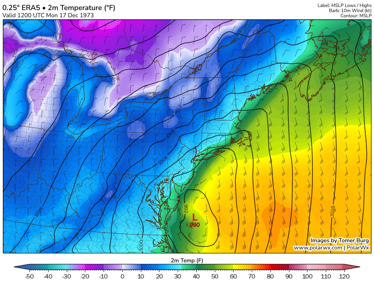
The storm was a nor’easter coming up the coast with a substantial warm layer just above the ground. The storm also featured a very cold air mass nearby (temperatures in the teens and single digits in northern New England) and a strong Canadian high lurking to the northwest.
The ERA5 reanalysis dataset shows the powerful nor’easter and high to the northwest. The surface low tracked just southeast of Connecticut locking in the cold air at the surface with a strong northerly wind and bitter cold to the north. As the cold advected south near the ground, warm air up in the clouds surged north on deep southerly flow.
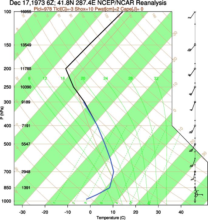
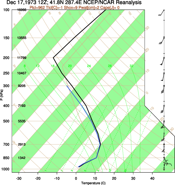
These reanalyzed soundings from the Hartford area show the warm layer of air aloft and the cold near the ground. You can also see the northerly wind at the ground and the southerly wind at 850hPa (~1400 meters). Not only does this show very strong warm advection (veering winds with height) it also helps illustrate why such a sharp inversion developed with freezing rain being the dominant precipitation type.
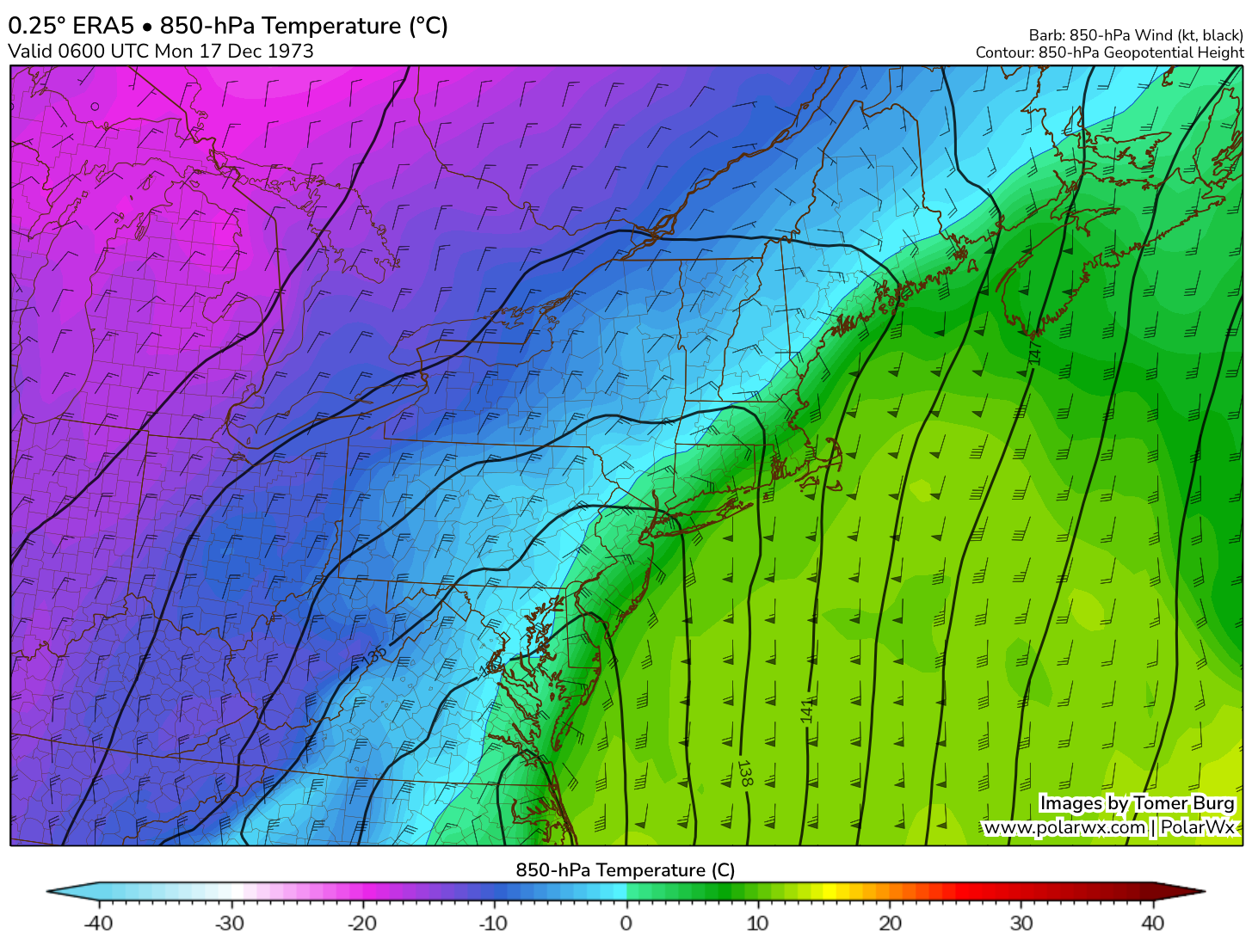
Another way of looking at why the storm produced so much ice is looking at the track of the low at the surface and the low at 850mb. The surface front was to the southeast of Connecticut while the front a few thousand feet up was to our northwest. That put the state on the cold side of the surface front but the warm side of the front aloft.
There have been other New England ice storms since 1973 - but none has impacted Connecticut as much as the ‘73 storm.
The January 1998 ice storm in northern New York, northern New England and Quebec produced exceptional damage. More than 2” of ice snapped entire forests and was enough to tear down steel transmission towers.
In December 2008 an ice storm hit upstate New York and central New England. More than 500,000 people in Massachusetts lost power. The storm only impacted a handful of hilltowns in northwest and northeast Connecticut.
After the ice storm temperatures plummeted. On the 18th the high was on 24F with a gusty wind and a low of 10F. The 19th was even colder with a morning low of 3F and a high of 16F. Brutally cold weather when you don’t have power or heat!
Governor Thomas Meskill was skiing in Vermont with family at the time of the ice storm. Many viewed his response inadequate and the ice storm was one of the reasons he chose not to run for reelection (Ella Grasso was elected . Meskill went on to have a long career as a judge in the United States Court of Appeals and was succeeded by Ella Grasso in 1975.
Special thanks to Tomer Burg for the wonderful ERA5 reanalysis charts.



My parents have strong memories of this one, as I was just 6 about 6 months old. Lots of fireplace cooking & bottle heating. 😀