


July 10, 1989 Tornado Outbreak
One of Only Two F4s in Connecticut During the 20th Century

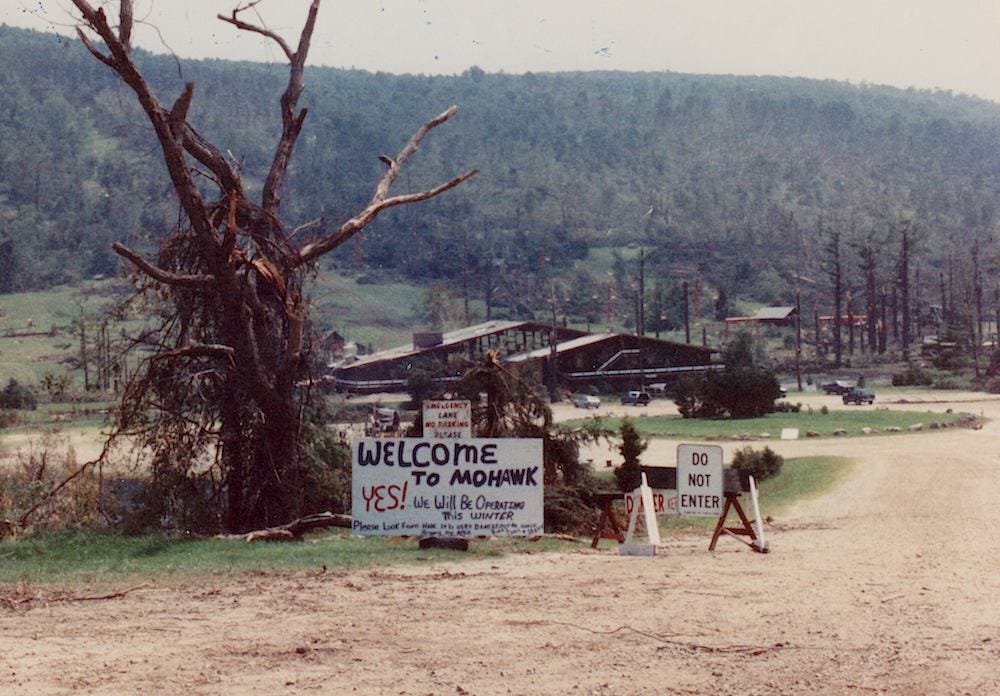
From Mohawk Mountain in Cornwall to Newhallville in New Haven the 1989 tornado was one of the most vicious to hit the state in modern times. While not as strong as the 1979 Windsor Locks tornado the ‘89 tornado was a beast.
One supercell produced a tornado intermittently from Schoharie County, New York to Long Island. Here in Connecticut several touchdowns occurred from the same storm.
Cornwall to Litchfield (F2)
Watertown to Waterbury (F2)
Hamden to New Haven (F4)
The weather pattern that day was classic for a violent tornado. In fact, the morning weather balloon launch from Albany featured an atmosphere that looked more like what you’d see in Oklahoma than what you’d see in the Northeastern United States.
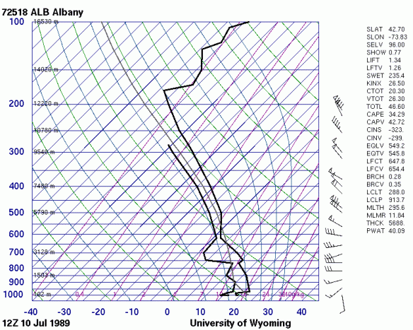
There are a couple things to note here. On the right you can see the wind profile through the atmosphere. Near the surface the wind was out of the south. Higher in the atmosphere the wind (which was quite strong) veered to a northwesterly direction. This means there was a *tremendous* amount of wind shear in the atmosphere.
But that’s not all. In the mid levels of the atmosphere a layer of very steep mid level lapse rates (temperatures decreasing rapidly with height) was in place due to the presence of an Elevated Mixed Layer (EML). A tremendous amount of instability was present.
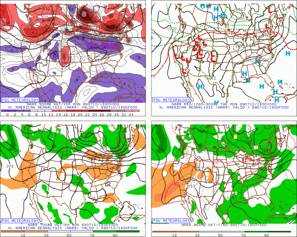
The reanalysis data shows a strong shortwave moving into New England by the afternoon of July 10, 1989. With that lift, strong instability, and impressive wind shear the stage was set for a substantial tornado event.

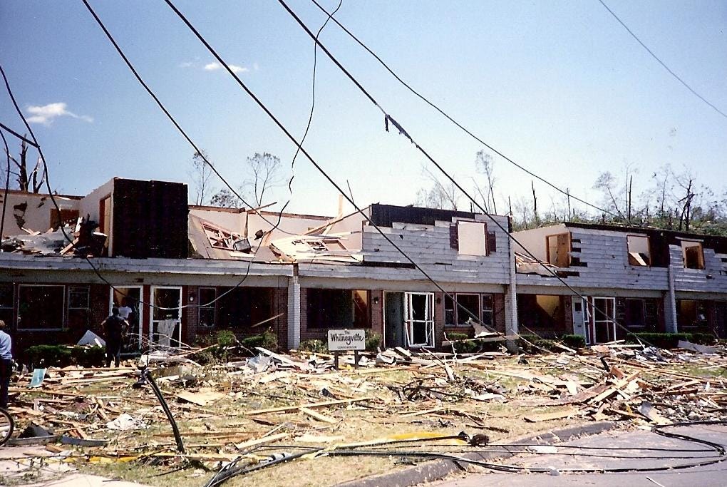
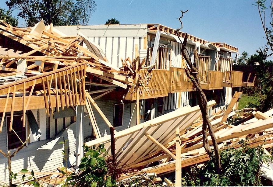
The July 10, 1989 tornado event produced at least 17 tornadoes across the northeastern United States. The two strongest tornadoes were rated as F4s - the Schoharie County, NY tornado and the Hamden-New Haven, CT tornado.
The 1989 tornado event only has a few events that were similarly destructive in New England. The 1953 Worcester tornado, the 1878 Wallingford tornado, the 1979 Windsor Locks tornado, and the 2011 Springfield tornado. There are very few severe weather events that were this prolific and violent.
Besides the tornadoes - large hail fell across parts of Connecticut (golf ball size in North Branford, for instance) as well as damaging straight line winds in parts of New Haven and East Haven.
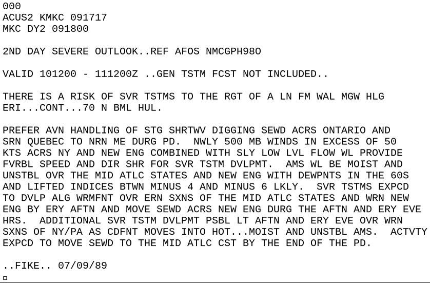
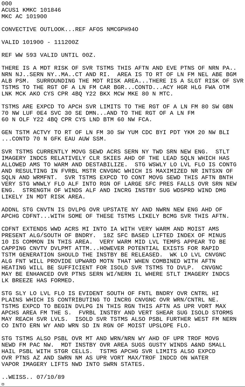
While I was under the impression that this was not a well forecast event based on anecdotes I’ve heard from that day it turns out that was not the case. While I’m not aware of any local TV meteorologists predicting tornadoes that day the National Weather Service was predicting a fairly high end severe weather event. The Weather Channel also highlighted the threat for severe thunderstorms the day prior.

Here’s a look at the Day 2 and the Day 1 severe weather outlooks from the Storm Prediction Center. On July 10, 1989 Connecticut was under a relatively rare “moderate risk” for severe thunderstorms.
Thanks to Mike Ekster at NWS Gray for pointing out the SPC outlooks from the 1989 tornado outbreak. Mike literally wrote the book (or paper) on Northeastern U.S. severe weather events like this one.