

Blah. Saturday isn’t looking great, with periods of rain expected across the state and the heaviest rainfall likely during the afternoon.
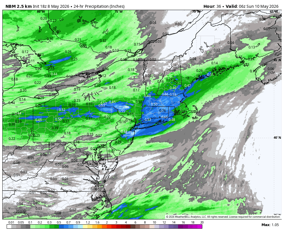
The National Blend of Models shows over 0.5" of rain across most of southern New England. If we look at some of the high-resolution models, a general 0.25"–0.50" of rain appears more widespread, with localized heavier pockets approaching 1". Either way, it’s a wet day.
Temperatures will struggle to get out of the 50s with clouds and rain throughout the day.
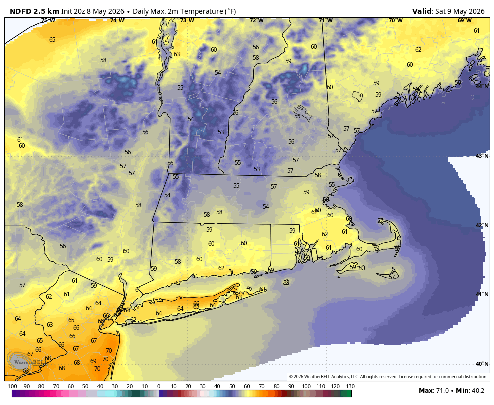
Most of Mother’s Day looks decent, with clouds, some sun, and a chance for showers. The best chance for rain will be during the afternoon, but the majority of the day should be dry. A bit of sunshine will help temperatures climb to near 70°.
There’s more uncertainty in the Sunday night and Monday forecast. The European model has shifted the rain offshore, a fairly dramatic change from yesterday. Interestingly, the Euro AI remains farther north and west.
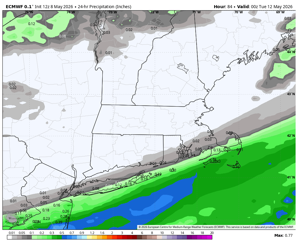
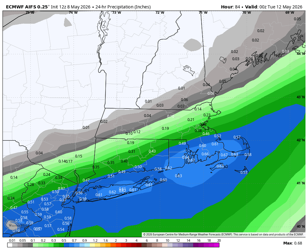
We’ll have to see if this trend continues over subsequent model runs. Right now, we’re expecting some rain, especially Monday morning, but confidence is now lower.
Tuesday and most of Wednesday should be pleasant, with temperatures in the 60s and a mix of clouds and sun. By late Wednesday and Thursday, however, things get more interesting. Both the GFS and Euro show a deep trough of low pressure developing over the northeastern United States, with a coastal low potentially forming off the Mid-Atlantic.
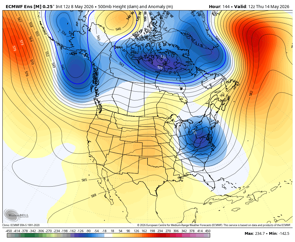
A period of rain, some wind, and chilly temperatures is possible later this week, depending on the track of that offshore low. Stay tuned.
Here is your Daily Weather Almanac for Saturday, May 09, 2026
🏙️ Hartford Area 30 Year Normals
- Normal High: 70°F
- Normal Low: 46°F
🏛️ Hartford Area (BDL) Records
- Record High (max temp): 97°F (1979)
- Record Low (min temp): 28°F (1956) ⚠️ (monthly record)
- Record Highest Minimum: 65°F (1964)
- Record Lowest Maximum: 45°F (1972)
- Record Precipitation: 2.20 in (1977)
- Record Snowfall: 1.3 in (1977) ⚠️ (monthly record)
- Max Snow Depth: 0 in (2025) ⚠️ (monthly record)
🏖️ Bridgeport Area (BDR) Records
- Record High (max temp): 84°F (2000)
- Record Low (min temp): 35°F (2020)
- Record Highest Minimum: 61°F (2000)
- Record Lowest Maximum: 48°F (1966)
- Record Precipitation: 1.11 in (1998)
- Record Snowfall: 0.0 in (2025) ⚠️ (monthly record)
- Max Snow Depth: 0 in (2025) ⚠️ (monthly record)
🌅 Sunrise & Sunset
- Sunrise: 05:37
- Sunset: 19:58
🌙 Moon Phase
----------------------------------------
- Next Moon Phase: Last Quarter on Sat May 09, 2026
📅 Calendar
----------------------------------------
- Next 3 Holidays:
- Mother's Day on Sun May 10 (in 1 day)
- Memorial Day on Mon May 25 (in 16 days)
- Juneteenth National Independence Day on Fri Jun 19 (in 41 days)
🌊 New Haven High Tides
- 05:09 AM EDT • 5.76 ft
- 05:47 PM EDT • 5.68 ft
🌊 Old Saybrook High Tides
- 04:51 AM EDT • 3.43 ft
- 05:37 PM EDT • 3.22 ft
🌊 New London High Tides
- 03:40 AM EDT • 2.52 ft
- 04:26 PM EDT • 2.37 ft