

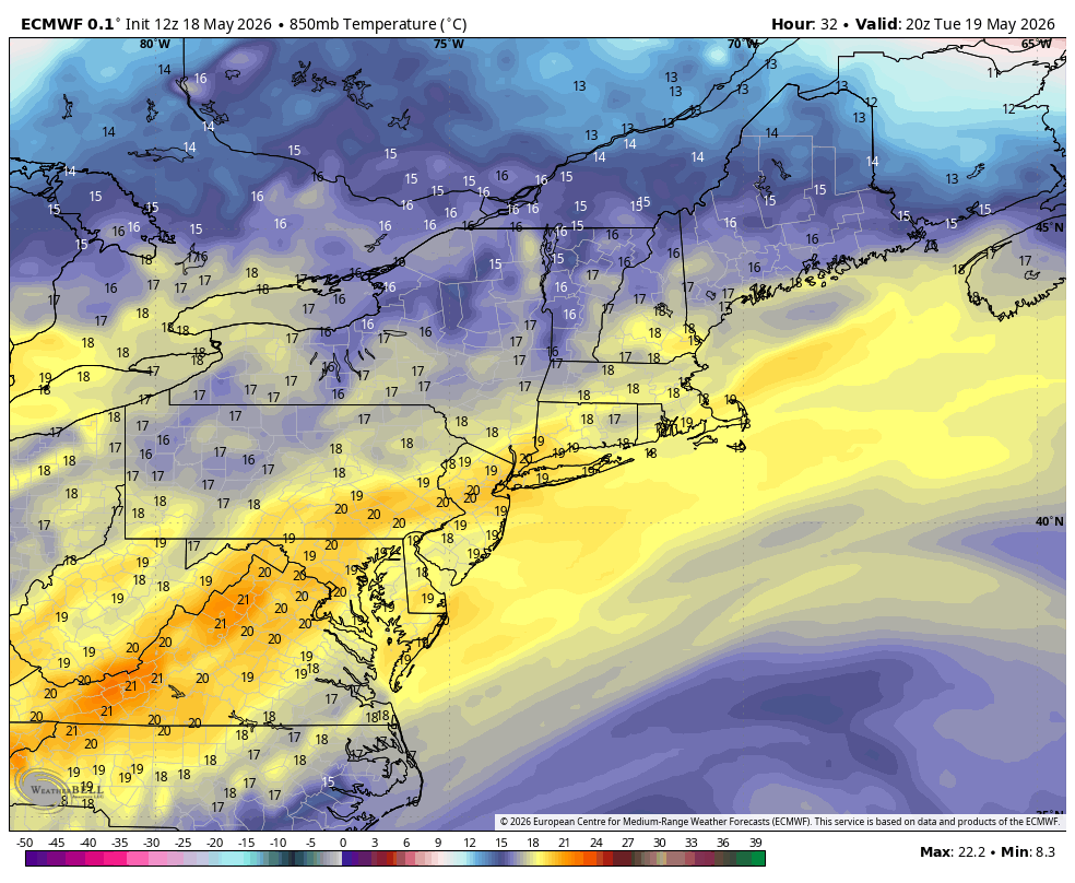
A Tuesday scorcher is on the way. A westerly wind and a warming airmass will send temperatures soaring. With 850mb temperatures approaching +20°C and that favorable wind direction, temperatures will reach record levels inland. I’m currently forecasting 97° in the Hartford area, but the National Blend of Models has a mean temperature of 99° for Bradley Airport.
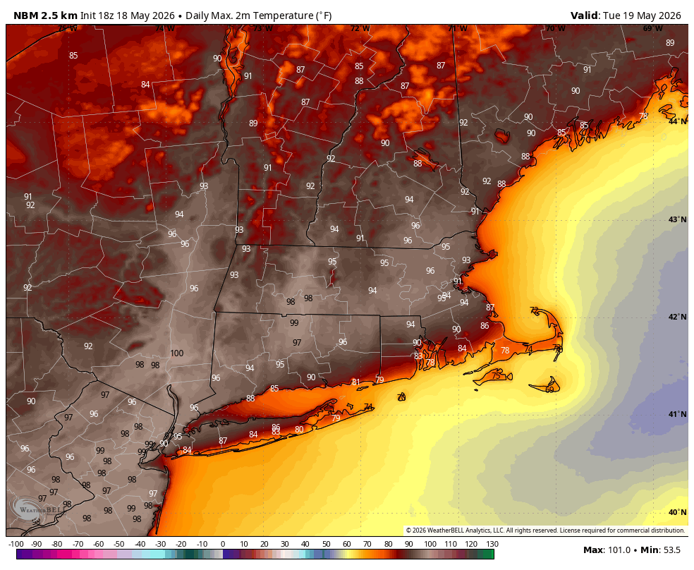
Getting into the upper 90s is tough to do this time of year. The warmest temperatures recorded in the Hartford area prior to May 31 are:
99° - May 26, 2010
99° - May 20, 1996
97° - May 9, 1979
96° - April 14, 2023 (and 4 prior years)
Also of note, there have only been 8 heat waves prior to May 31. The most recent occurred May 17-19, 2017. There are no instances of 4 consecutive 90° days this early in the year.
There’s a low risk for a severe thunderstorm Tuesday. With a big upper-level ridge overhead, there won’t be much forcing to initiate storm development. That said, there is a fair amount of CAPE (instability) and wind shear, so any storm that develops could become severe.
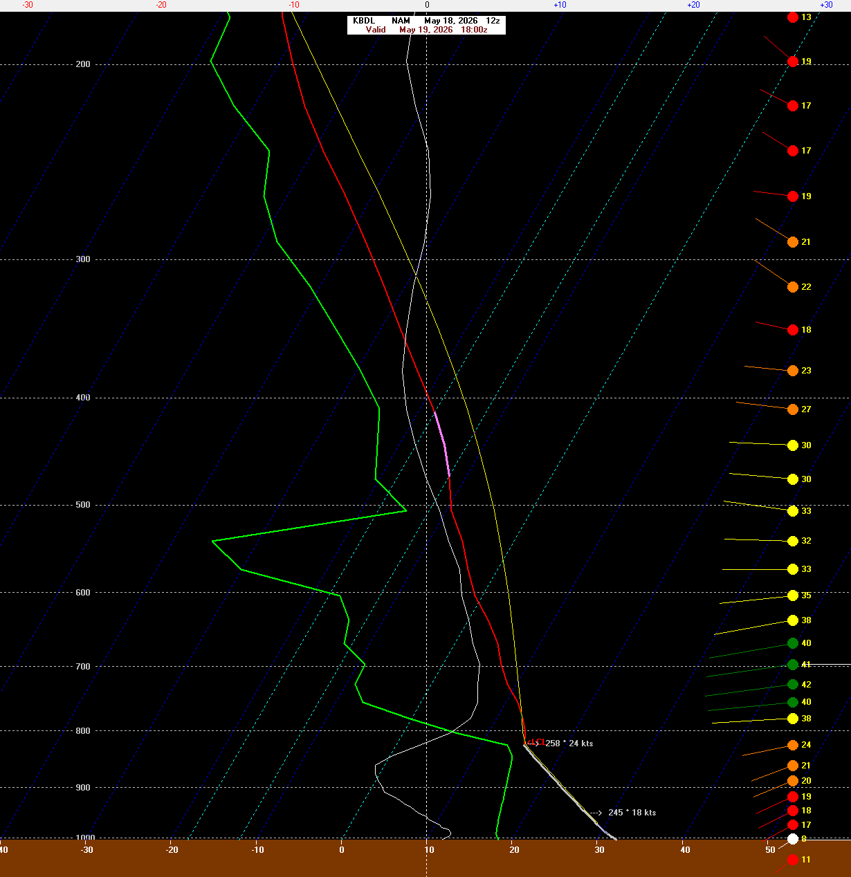
There’s a bigger risk for severe thunderstorms on Wednesday as a cold front moves in from the northwest. Temperatures will climb to near 90° along with increasing humidity. There will be sufficient instability and wind shear for severe weather, with damaging winds and large hail possible in the strongest storms.
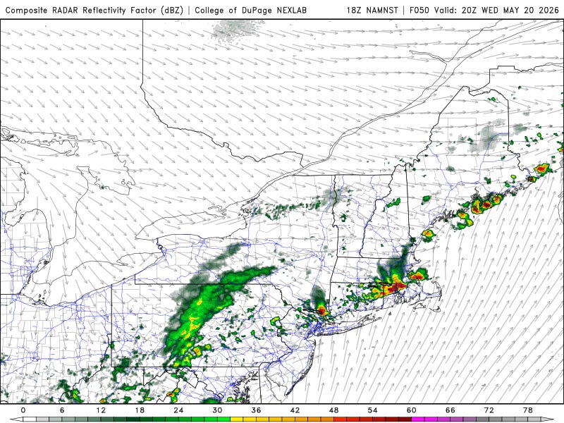
High-resolution models show the potential for severe storms with modest mid-level rotation. We are currently in a level 1 out of 5 risk for severe weather, but I expect this will be upgraded to a level 2 risk tomorrow.
Thursday and Friday look quiet with a mix of sun and clouds and highs near 70°.
The weekend looks problematic. Both the GFS and Euro ensembles show rain both days, with a large area of overrunning ahead of an area of low pressure moving in from the southwest.
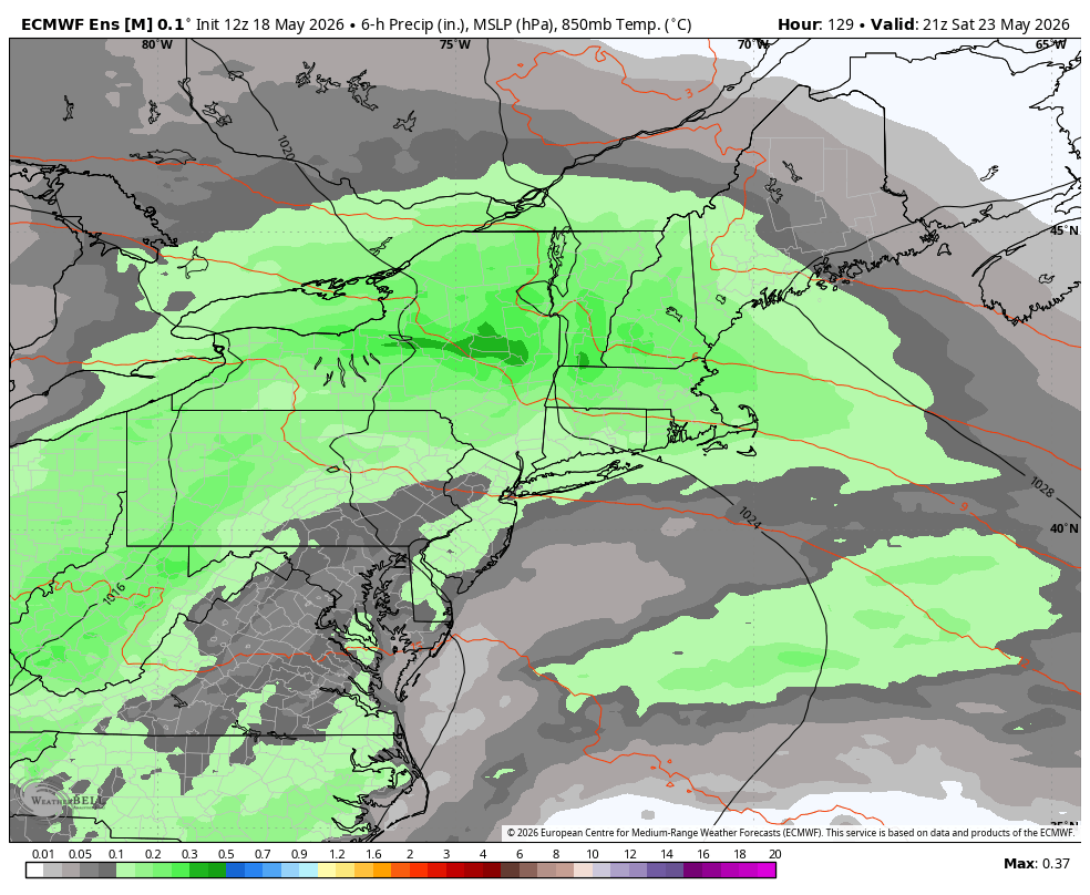
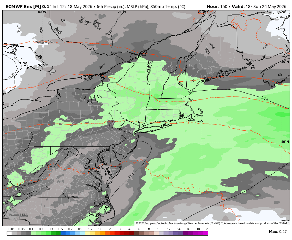
To make matters worse, some of our guidance shows temperatures stuck in the upper 40s and low 50s for a period of time, with onshore flow and cold air damming developing. This is the kind of setup that would have brought snow or ice a month and a half ago.
This isn’t set in stone. A stronger high could shunt this whole system south, but right now the weekend forecast is not looking promising.
Here is your Daily Weather Almanac for Tuesday, May 19, 2026
🏙️ Hartford Area 30 Year Normals
- Normal High: 73°F
- Normal Low: 49°F
🏛️ Hartford Area (BDL) Records
- Record High (max temp): 94°F (1962)
- Record Low (min temp): 34°F (2009)
- Record Highest Minimum: 62°F (1969) (tie — also in 1911)
- Record Lowest Maximum: 48°F (1950)
- Record Precipitation: 1.23 in (1999)
- Record Snowfall: 0.0 in (2025)
- Max Snow Depth: 0 in (2025) ⚠️ (monthly record)
🏖️ Bridgeport Area (BDR) Records
- Record High (max temp): 89°F (2017)
- Record Low (min temp): 38°F (2002)
- Record Highest Minimum: 66°F (2017)
- Record Lowest Maximum: 49°F (1950)
- Record Precipitation: 1.59 in (1966)
- Record Snowfall: 0.0 in (2025) ⚠️ (monthly record)
- Max Snow Depth: 0 in (2025) ⚠️ (monthly record)
🌅 Sunrise & Sunset
- Sunrise: 05:27
- Sunset: 20:08
🌙 Moon Phase
----------------------------------------
- Next Moon Phase: First Quarter on Sat May 23, 2026
📅 Calendar
----------------------------------------
- Next 3 Holidays:
- Memorial Day on Mon May 25 (in 6 days)
- Juneteenth National Independence Day on Fri Jun 19 (in 31 days)
- Father's Day on Sun Jun 21 (in 33 days)
🌊 New Haven High Tides
- 01:26 AM EDT • 7.49 ft ⚠️
- 02:06 PM EDT • 6.48 ft
🌊 Old Saybrook High Tides
- 12:41 AM EDT • 4.92 ft
- 01:15 PM EDT • 3.62 ft
🌊 New London High Tides
- 12:04 PM EDT • 2.66 ft