

After a chilly weekend, we’re heading into a 48-hour stretch of unseasonably warm air.
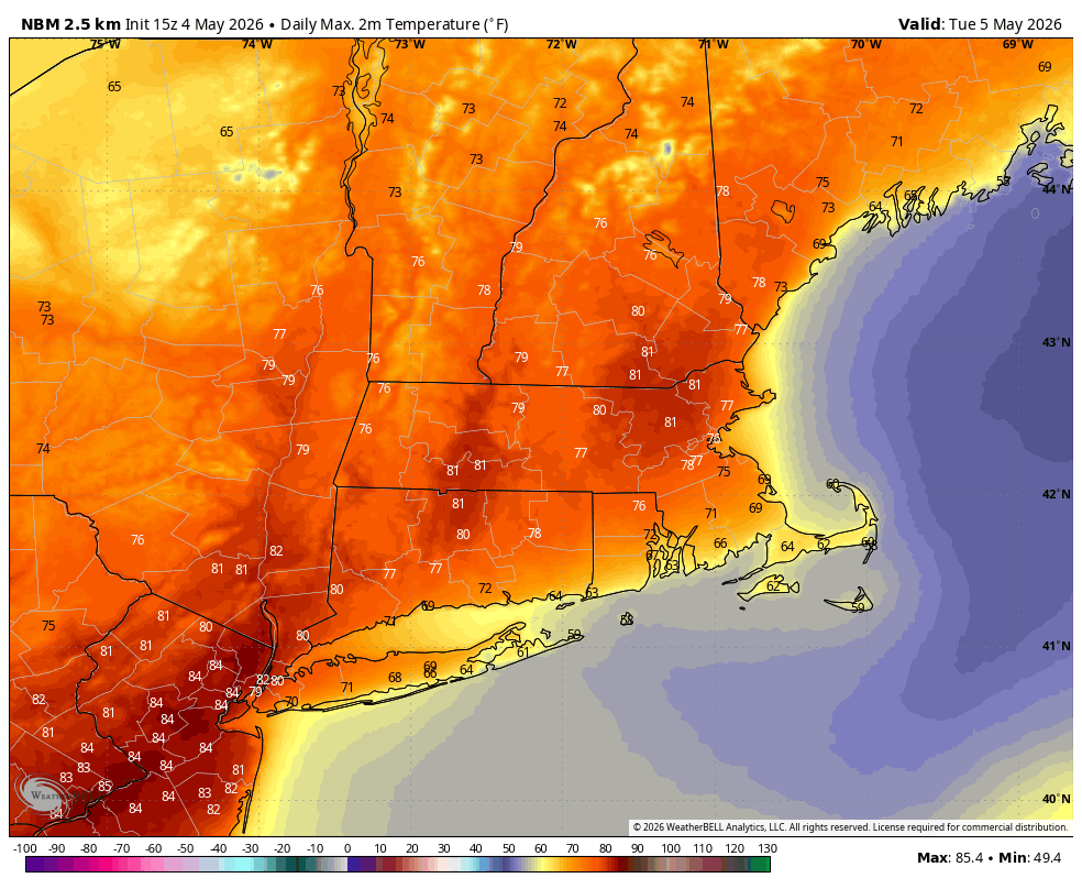
Temperatures will reach around 80° in many towns away from Long Island Sound on Tuesday. Expect a mix of sunshine and a few clouds throughout the day. Even though it will be warm, it will also be quite windy.
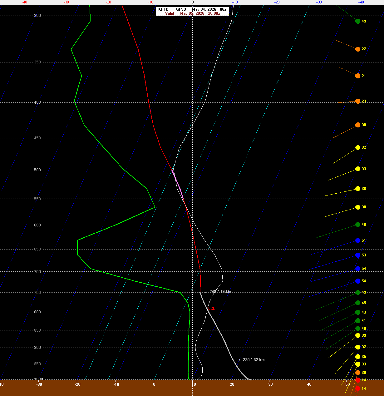
Gusts of up to 45 mph can be expected across Connecticut, especially just inland from the Sound. This sounding off the GFS for Tuesday afternoon shows a well-mixed boundary layer (the air between about 8,000 ft and the ground), which will promote the mixing of stronger winds down to the surface. In fact, the wind speed at the top of the mixed layer is 49 kt, and it’s certainly reasonable to expect 80% or more of that to mix down.
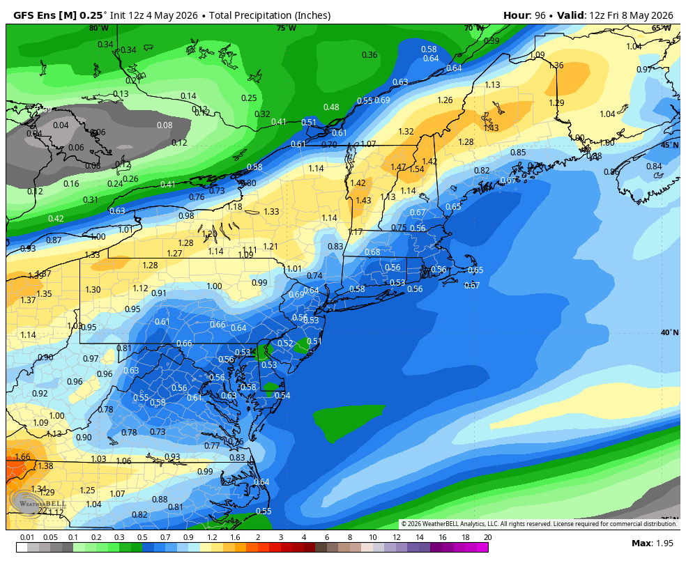
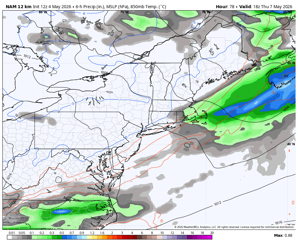
A front approaches Wednesday, and with it will come more cloud cover and a chance for showers later in the day. This system looks a bit more progressive than it did over the weekend, which means two things: First, the bulk of the rain should move out by Thursday morning. Second, overall rainfall totals will be lower (generally less than 1") thanks to the system’s progressive nature.
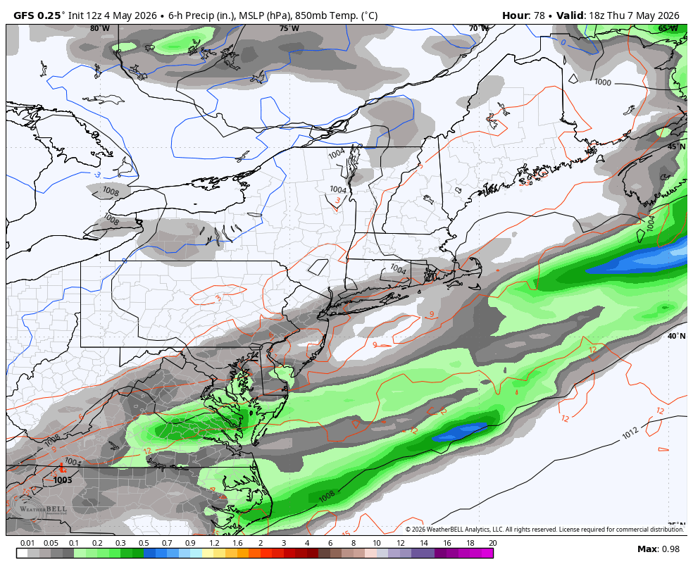
There is a scenario, however, where the system doesn’t move as quickly and we get clipped by a wave of low pressure on Thursday. The NAM and the GFS (pictured below) show little precipitation beyond 8 a.m. Thursday, as the front moves through and drier air moves in.
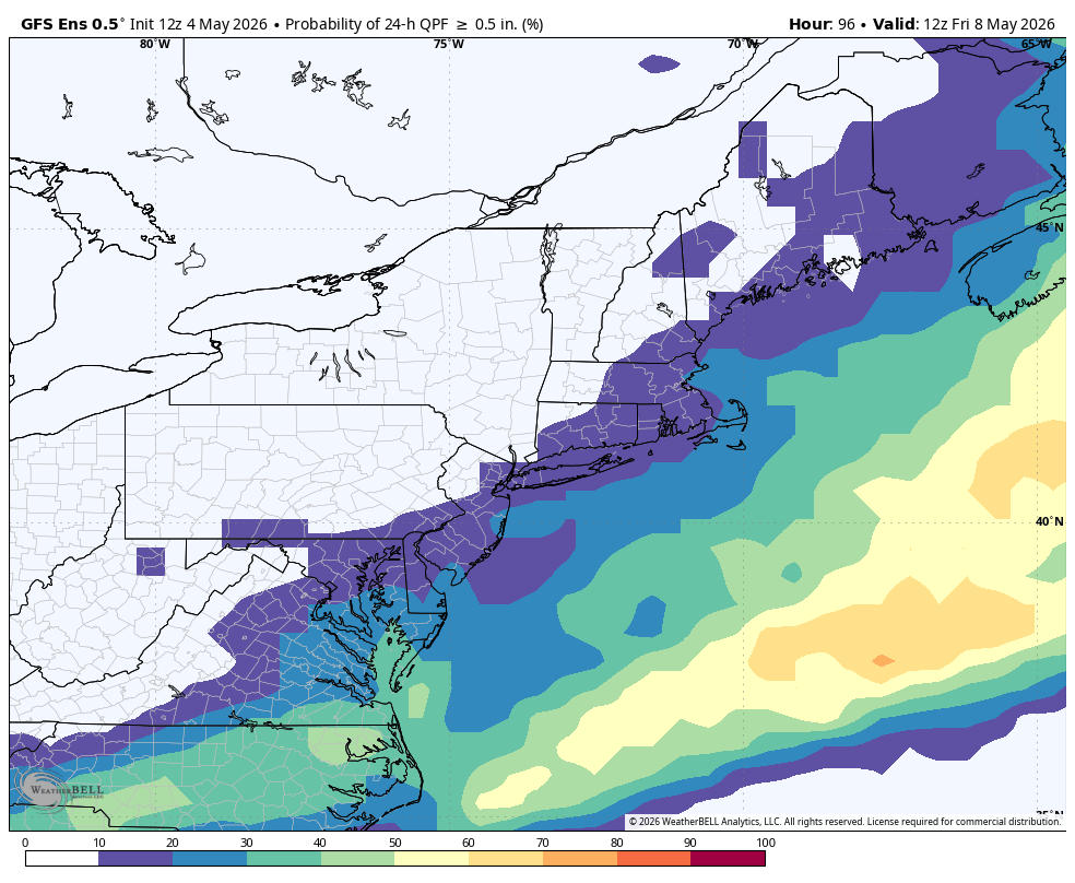
The GFS ensembles, however, show a nonzero chance for lingering rain if that wave clips the region on Thursday. In fact, the odds of more than 0.5” of rain are anywhere between 10% and 20% across most of Connecticut. Not a huge risk, but not something to ignore.
At this point, plan for clouds and at least some showers Thursday, but this remains a relatively low-confidence forecast.
Beyond Thursday, the weather pattern remains unsettled, with several more chances for showers and cooler-than-normal temperatures into Mother’s Day weekend.