
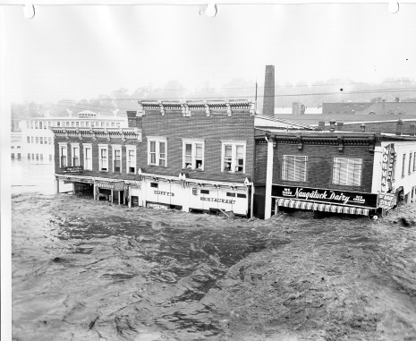
August 1955 Flood
One of Connecticut's Worst Natural Disasters Followed Tropical Storms Connie and Diane

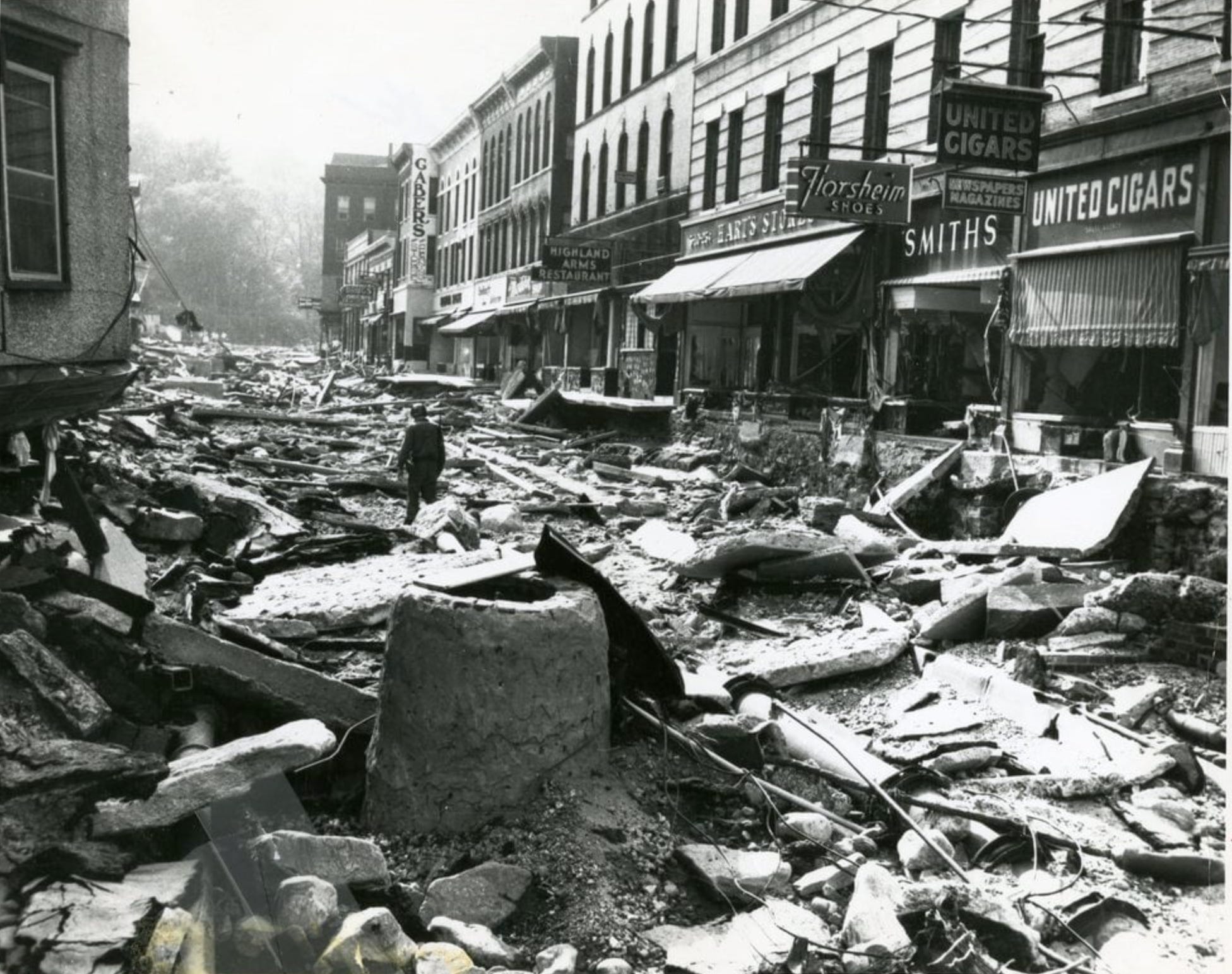
It’s still hard to fathom how anomalous and how devastating the Flood of ‘55 was 70 years later. The records set in many parts of the state still stand today - both in terms of total rainfall and river levels. The numbers are extraordinary. The flooding was widespread with records set from the Northwest Hills and Berkshires east into the Quiet Corner and Central Massachusetts.
Hurricane Connie made landfall in North Carolina on August 12, 1955 as a category 3 storm. It was a powerful hurricane that dropped a tremendous amount of rain across the Mid Atlantic and Northeast.
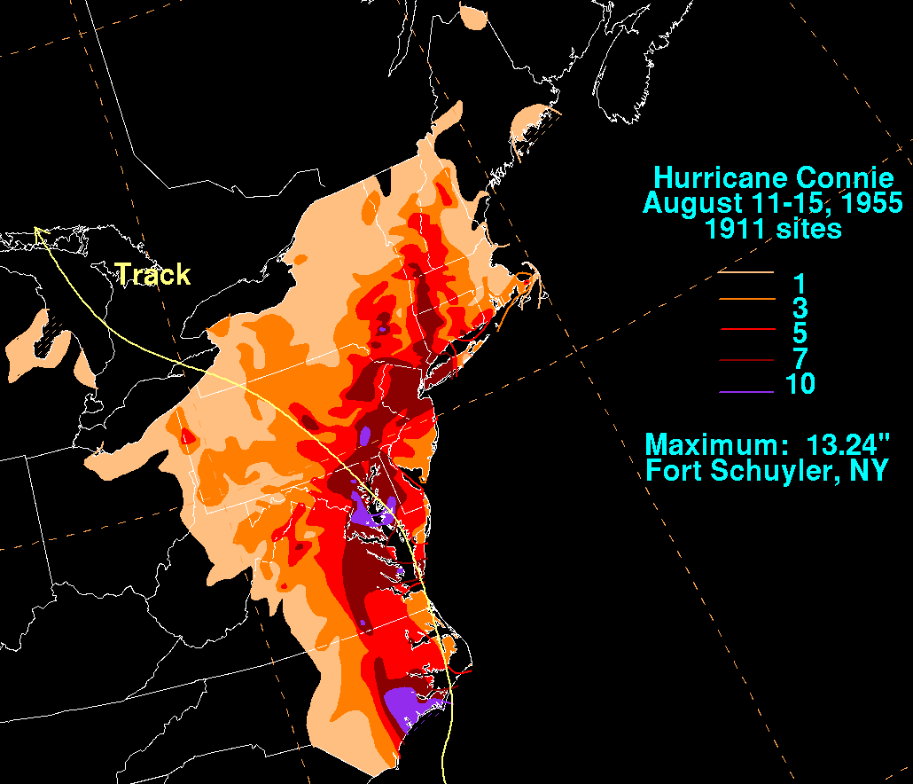
The Connie rainfall totals alone were very significant with 9.11” in Barkhamsted and 8.73’ in Burlington!
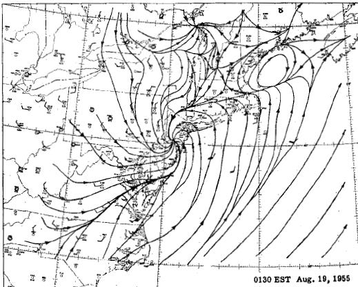
But it was Tropical Storm Diane that turned a bad situation into a catastrophe. The storm made landfall not far from where Connie did on the North Carolina coast just 5 days later on August 17, 1955. The storm moved north and then curved out to sea as it got caught in the jet stream.
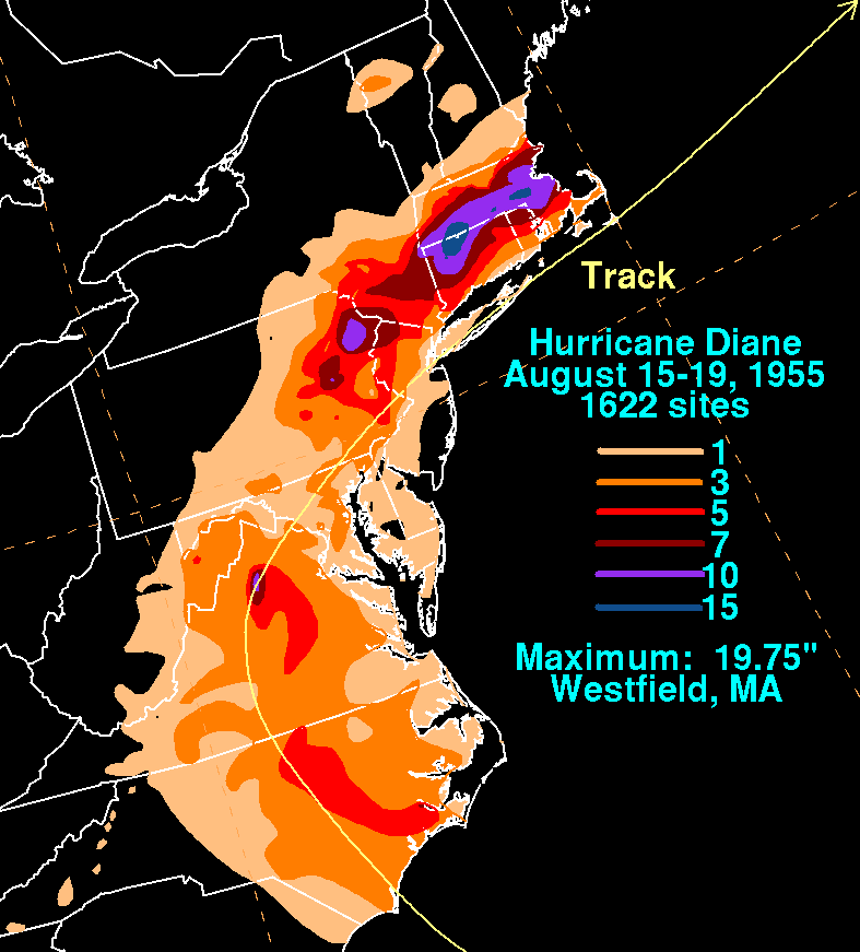
To the north of Diane’s track a stationary front developed resulting in tremendous low level convergence.
Deep tropical moisture streamed north and an area of heavy rain developed along the front. There was likely some enhancement to the rain as the southerly and southeasterly flow rose over the hills (orographic lift). For this to happen just 5 days after an extreme rainfall event is unprecedented since colonial times.
Rainfall totals from Diane exceeded a foot in most of northern Connecticut and adjacent Massachusetts. With river levels already quite high and soils saturated after Connie the results were devastating.
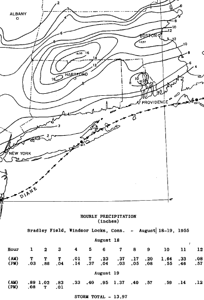
One of my favorite statistics from the Flood of ‘55 is that the Hartford area’s two wettest days in recorded history (going back to 1905) occurred on August 18, 1955 and August 19, 1955 with 7.70” and 6.27”, respectively. Setting an all-time record for the wettest day is noteworthy enough but to do it on two consecutive days is jaw-dropping.
Records stand to this day on many of Connecticut’s rivers. Some spots on the Farmington, Naugatuck, Housatonic and Quinebaug Rivers have not seen crests as high as the ‘55 flood since. Take the Farmington River at Unionville for example. On August 19, 1955 the river reached 32.90’. The second highest crest of 18.55’ was after Irene. That’s a 14 foot delta between the number 1 and number 2 floods on record!
Following the 1955 flood dams, dikes, levees, and reservoirs were constructed by the Army Corps of Engineers to prevent another disaster like this from occurring again. The Farmington, Naugatuck, and Quinebaug rivers are extensively flood controlled. Even if we saw rainfall totals like August 1955 again the result would be bad not as bad.